|
|
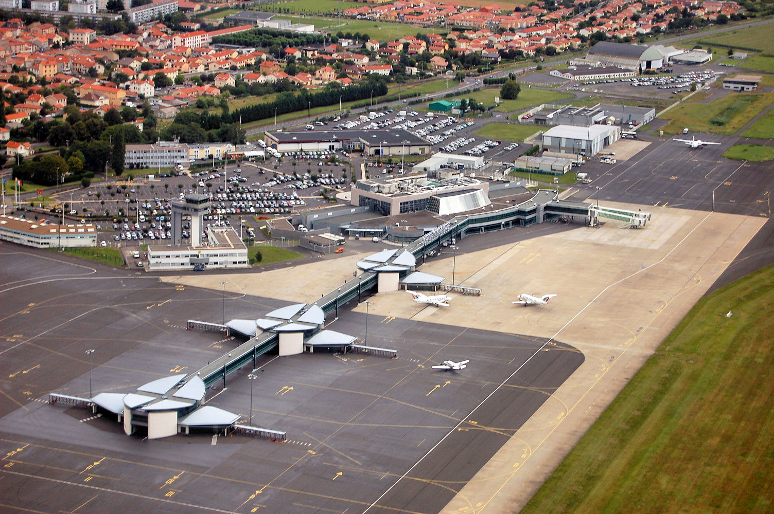
Clermont-Ferrand Auvergne Airport
Aéroport de Clermont-Ferrand Auvergne |
 |
| IATA: CFE – ICAO: LFLC |
| Summary |
| Airport type |
Public |
| Operator |
CCI de Clermont-Ferrand / Issoire |
| Location |
Clermont-Ferrand |
| Elevation AMSL |
1,090 ft / 332 m |
| Coordinates |
45°47′09″N 003°09′45″E / 45.78583°N 3.1625°E / 45.78583; 3.1625Coordinates: 45°47′09″N 003°09′45″E / 45.78583°N 3.1625°E / 45.78583; 3.1625 |
| Runways |
| Direction |
Length |
Surface |
| ft |
m |
| 08/26 |
9,892 |
3,015 |
Asphalt |
Clermont-Ferrand Auvergne Airport (French: Aéroport de Clermont-Ferrand Auvergne) (IATA: CFE, ICAO: LFLC) is an airport serving the French city of Clermont-Ferrand. It is located 6.7 km east of the city, in Aulnat, a commune of the département of Puy-de-Dôme. Airlines and destinations
| Airlines |
Destinations |
| Air France |
Paris-Orly |
| Air France operated by Brit Air |
Paris-Orly |
| Air France operated by Régional |
Ajaccio [seasonal], Amsterdam, Bastia [seasonal], Lyon, Nantes, Nice, Paris-Charles de Gaulle |
Final approach to the airportIn 2001 and 2002 Regional Airlines operated a scheduled service to London City Airport using Saab 2000 twin-turboprop aircraft.
Accidents and incidents
- On 28 December 1971, Vickers Viscount F-BOEA of Air Inter was damaged beyond economic repair when it departed the runway on a training flight during a simulated failure of #4 engine.
- On 27 October 1972, Air Inter Flight 696, Vickers Viscount 724 F-BMCH, en route from Lyon to Clermont-Ferrand, crashed 4 km west of Noirétable during bad weather; 60 on board died, 8 survived. The subsequent investigation determined that the accident was caused by the flight crew's failure to notice that their plane's radio compass had shifted 180 degrees, most likely the result of electrical discharges in the rainstorm they were flying through; this blocked the signals emitted by Clermont-Ferrand's non-directional beacon (NDB), which was instructing the crew to fly a holding pattern prior to receiving clearance to descend to 3,600 ft.
The above content comes from Wikipedia and is published under free licenses – click here to read more.
| General Info
|
| Country |
France
|
| ICAO ID |
LFLC
|
| Time |
UTC+1(+2DT)
|
| Latitude |
45.786661
45° 47' 11.98" N
|
| Longitude |
3.169169
003° 10' 09.01" E
|
| Elevation |
1090 feet
332 meters
|
| Type |
Civil
|
| Magnetic Variation |
000° W (01/06)
|
| Operating Agency |
CIVIL GOVERNMENT, (LANDING FEES AND DIPLOMATIC CLEARANCE MAY BE REQUIRED)
|
| Near City |
Clermont Ferrand
|
| Operating Hours |
24 HOUR OPERATIONS
|
| International Clearance Status |
Airport of Entry
|
| Daylight Saving Time |
Last Sunday in March to last Sunday in October
|
| Communications
|
| CLERMONT TWR |
118.625
|
| CLERMONT GND |
121.95
|
| CLERMONT ATIS |
136.4
|
| CLERMONT APP |
120.325
128.625
375.4
|
| Runways
|
| ID |
Dimensions |
Surface |
PCN |
ILS
|
| 08/26 |
9892 x 148 feet
3015 x 45 meters |
ASPHALT |
- |
YES
|
| Navaids
|
| Type |
ID |
Name |
Channel |
Freq |
Distance From Field |
Bearing From Navaid
|
| VOR-DME |
CFA |
CLERMONT |
090Y |
114.35 |
1.0 NM |
268.3
|
| Supplies/Equipment
|
| Fuel |
JP-8, SemiKeroscene MIL Spec T-83133, without icing inhibitor
100/130 MIL Spec, low lead, aviation gasoline (BLUE)
|
| Remarks
|
| FUEL |
0500-2200Z++ Mon-Fri, 0500-1930Z++ Sat, 0830-2130Z++ Sun and hol. OT O/R. (NC-100LL, A1+)
|
| LGT |
PAPI Rwy 26 MEHT 61'.
|
| OIL |
O-113-117
|
| RSTD |
When RVR is 400M or less, stop bars OTS and limit one acft taxiing on movement area.
|
The content above was published at Airports-Worldwide.com in 2010.
We don't guarantee the information is fresh and accurate. The data may be wrong or outdated.
For more up-to-date information please refer to other sources.
|
|