|
|
Albert - Picardie Airport
Aéroport d'Albert - Picardie |
 |
| IATA: none – ICAO: LFAQ
Location of airport in France
|
| Summary |
| Airport type |
Public |
| Operator |
Société d’Exploitation Aéroport Albert Picardie (SEAAP) |
| Serves |
Albert, Somme, France |
| Location |
Bray-sur-Somme |
| Elevation AMSL |
363 ft / 111 m |
| Coordinates |
49°58′12″N 002°41′33″E / 49.97°N 2.6925°E / 49.97; 2.6925 |
| Website |
AeroportAlbertPicardie.fr |
| Runways |
| Direction |
Length |
Surface |
| m |
ft |
| 09/27 |
2,200 |
7,218 |
Macadam |
| 09R/27L |
1,000 |
3,281 |
Grass |
| Sources: French AIP, UAF |
Albert - Picardie Airport (French: Aéroport d'Albert - Picardie) (ICAO: LFAQ), sometimes referred to as Albert - Picardy Airport, is an airport serving Albert, a commune of the Somme department in the Picardy (Picardie) region of northern France. The airport is located 4 km (2 mi) southeast of Albert, in Bray-sur-Somme.
 | |
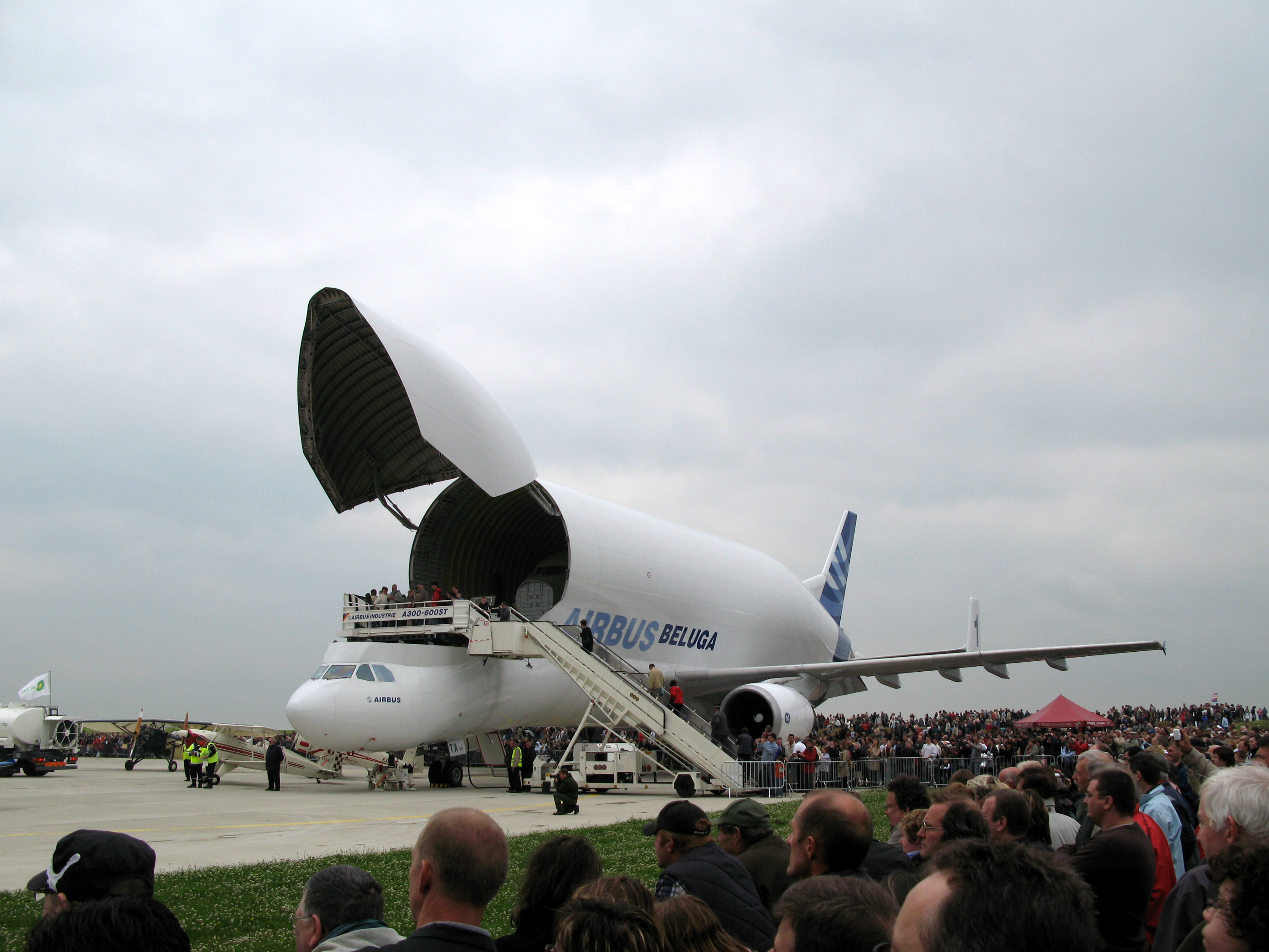
Airbus Beluga at Albert-Picardie (2008) |
It is primarily used for the transportation of Airbus aircraft parts from the nearby Méaulte Airbus Factory. The airport's runway is large enough to accommodate Airbus' Beluga aircraft, a large cargo aircraft used to courier parts used in the construction of its own commercial jets.
The airport is also home to a flying club, who have a number of light aircraft based at the airfield.
The British low-cost carrier Jet2.com announced and then canceled a planned twice-weekly service to the Somme using this airport, flights were to start in April 2009.
Facilities
The airport resides at an elevation of 364 feet (111 m) above mean sea level. It has one paved runway designated 09/27 which measures 2,200 by 45 metres (7,218 × 148 ft). It also has a parallel unpaved runway with a grass surface measuring 1,000 by 80 metres (3,281 × 262 ft).
The above content comes from Wikipedia and is published under free licenses – click here to read more.
| General Info
|
| Country |
France
|
| ICAO ID |
LFAQ
|
| Time |
UTC+1(+2DT)
|
| Latitude |
49.971531
49° 58' 17.51" N
|
| Longitude |
2.697661
002° 41' 51.58" E
|
| Elevation |
364 feet
111 meters
|
| Magnetic Variation |
001° W (01/06)
|
| Operating Agency |
CIVIL GOVERNMENT, (LANDING FEES AND DIPLOMATIC CLEARANCE MAY BE REQUIRED)
|
| Near City |
Albert
|
| Operating Hours |
NO OPERATING HOURS LISTED
|
| Daylight Saving Time |
Last Sunday in March to last Sunday in October
|
| Runways
|
| ID |
Dimensions |
Surface |
PCN |
ILS
|
| 09/27 |
3838 x 82 feet
1170 x 25 meters |
ASPHALT |
- |
NO
|
| Remarks
|
| OPR HOURS |
Opr HX.
|
The content above was published at Airports-Worldwide.com in 2010.
We don't guarantee the information is fresh and accurate. The data may be wrong or outdated.
For more up-to-date information please refer to other sources.
|
|