 |
|
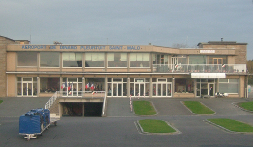
Dinard - Pleurtuit - Saint-Malo Airport
Aéroport de Dinard - Pleurtuit - Saint-Malo |
 |
| IATA: DNR – ICAO: LFRD |
| Summary |
| Airport type |
Public |
| Operator |
CCI du Pays de Saint-Malo |
| Serves |
Saint-Malo |
| Location |
Pleurtuit |
| Elevation AMSL |
219 ft / 67 m |
| Coordinates |
48°35′16″N 002°04′48″W / 48.58778°N 2.08°W / 48.58778; -2.08 |
| Website |
http://www.saint-malo.cci.fr/en/services/airport/ |
| Runways |
| Direction |
Length |
Surface |
| m |
ft |
| 17/35 |
2,200 |
7,218 |
Asphalt concrete |
| 12/30 |
1,435 |
4,708 |
Asphalt concrete |
| 17R/35L |
150 |
492 |
Grass |
| Source: French AIP |
Dinard - Pleurtuit - Saint-Malo Airport or Aéroport de Dinard - Pleurtuit - Saint-Malo (IATA: DNR, ICAO: LFRD) is an airport serving the city of Saint-Malo, France. It is located 5 km (3.2 miles) south-southwest of Dinard in Pleurtuit, a commune of the département of Ille-et-Vilaine.
Airlines and destinations
| Airlines |
Destinations |
| Aurigny Air Services |
Guernsey |
| Lydd Air |
Lydd [seasonal] |
| Ryanair |
East Midlands, London-Stansted |
The above content comes from Wikipedia and is published under free licenses – click here to read more.
| General Info
|
| Country |
France
|
| ICAO ID |
LFRD
|
| Time |
UTC+1(+2DT)
|
| Latitude |
48.587683
48° 35' 15.66" N
|
| Longitude |
-2.079958
002° 04' 47.85" W
|
| Elevation |
219 feet
67 meters
|
| Type |
Civil
|
| Magnetic Variation |
002° W (01/06)
|
| Operating Agency |
CIVIL GOVERNMENT, (LANDING FEES AND DIPLOMATIC CLEARANCE MAY BE REQUIRED)
|
| Near City |
Saint Malo
|
| Operating Hours |
SEE REMARKS FOR OPERATING HOURS OR COMMUNICATIONS FOR POSSIBLE HOURS
|
| International Clearance Status |
Airport of Entry
|
| Daylight Saving Time |
Last Sunday in March to last Sunday in October
|
| Communications
|
| DINARD TWR |
120.15
|
| DINARD ATIS |
124.575
|
| Runways
|
| ID |
Dimensions |
Surface |
PCN |
ILS
|
| 12/30 |
4708 x 148 feet
1435 x 45 meters |
ASPHALT |
020FCWT |
NO
|
| 17/35 |
7218 x 148 feet
2200 x 45 meters |
ASPHALT |
037FCWT |
YES
|
| Navaids
|
| Type |
ID |
Name |
Channel |
Freq |
Distance From Field |
Bearing From Navaid
|
| VOR-DME |
DIN |
DINARD |
090X |
114.3 |
At Field |
-
|
| Supplies/Equipment
|
| Fuel |
Jet A1, without icing nhibitor.
100/130 MIL Spec, low lead, aviation gasoline (BLUE)
|
| Remarks
|
| CAUTION |
Bird haz.
|
| FUEL |
(NC-100LL avbl arpt hrs, OT 12 hr PN rqr; A1 avbl 0500-2000Z++ Mon-Fri, OT and hol 1 hr PN rqr) fone C02.99.82.72.12.
|
| LGT |
Activate HIRL Rwy 17, 35 on 120.15. PAPI Rwy 17 GS 3.9 MEHT 60', PAPI Rwy 35 MEHT 43'.
|
| MISC |
Class D airspace dur opr hrs . OT Class G.
|
| OPR HOURS |
Opr 0615-1945Z++ Mon-Fri. Sat, Sun, hol opr 0830-1800Z 30 Oct-17 Mar, 0615-1845Z18 Mar-29 Oct.
|
| RSTD |
NORDO proh.
|
| RWY |
Rwy 12/30 unuse outside opr hrs.
|
The content above was published at Airports-Worldwide.com in 2010.
We don't guarantee the information is fresh and accurate. The data may be wrong or outdated.
For more up-to-date information please refer to other sources.
|
|


