 |
|
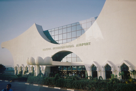
| Banjul International Airport |
 |
| IATA: BJL – ICAO: GBYD |
| Summary |
| Airport type |
Public |
| Location |
Banjul |
| Elevation AMSL |
95 ft / 29 m |
| Coordinates |
13°20′16.66″N 16°39′07.94″W / 13.3379611°N 16.6522056°W / 13.3379611; -16.6522056Coordinates: 13°20′16.66″N 16°39′07.94″W / 13.3379611°N 16.6522056°W / 13.3379611; -16.6522056 |
| Runways |
| Direction |
Length |
Surface |
| ft |
m |
| 14/32 |
11,811 |
3,600 |
Asphalt |
Banjul International Airport also known as Yundum International (IATA: BJL, ICAO: GBYD) is the international airport of Banjul, capital of The Gambia.
In 2004, the airport served 967,719 passengers.
In the event of an emergency on any of the NASA Space Shuttles, Banjul International Airport had been selected as an augmented landing site. The Gambia was the perfect location when the shuttle was launched with a low, 28-degree inclination.
In 2001 NASA announced that Banjul airport would no longer be used as an augmeted landing site because today, NASA sends shuttles up at 51.6 degrees to the International Space Station, making air bases in Spain and France better emergency landing spots.
According to current president Yahya Jammeh, the Banjul airport was built by the Lobstancers of Germany. Airlines and destinations
| Airlines |
Destinations |
| Air Nigeria |
Abidjan, Accra, Cotonou, Dakar, Lagos |
| Arik Air |
Freetown, Dakar, Lagos |
| Brussels Airlines |
Brussels |
| Elysian Airlines |
Conakry, Freetown |
| Ethiopian Airlines operated by ASKY Airlines |
Abidjan, Accra, Dakar, Lomé |
| Mauritania Airways |
Nouakchott |
| Royal Air Maroc |
Casablanca |
| Spanair |
Barcelona |
| TACV |
Freetown, Praia |
Charter
| Airlines |
Destinations |
| Arkefly |
Amsterdam |
| Hamburg International |
Bristol, East Midlands |
| Mahfooz Aviation |
Bissau, Dakar |
| Monarch Airlines |
London-Gatwick, Manchester |
| Neos |
Milan-Malpensa |
| Thomas Cook Airlines |
Birmingham, East Midlands, Glasgow-International, London-Gatwick, Manchester |
| Thomas Cook Airlines Scandinavia |
Copenhagen, Oslo-Gardermoen, Stockholm-Arlanda |
| Viking Airlines |
London-Gatwick [Seasonal] |
Accidents and incidents
- 7 September 1946: British South American Airways, a Avro 685 York I registration G-AHEW named "Star Leader" flying from London to Buenos Aires via Lisbon, Bathurst (now Banjul), Natal, Rio de Janeiro-Santos Dumont and Montevideo lost control and crashed shortly after takeoff from Bathurst. The cause of the loss of control cannot be determined with certainty, but that it was due to a mishandling of the controls by the captain is the most likely explanation. All 24 occupants died.
The above content comes from Wikipedia and is published under free licenses – click here to read more.
| General Info
|
| Country |
Gambia, The
|
| ICAO ID |
GBYD
|
| Time |
UTC 0
|
| Latitude |
13.337961
13° 20' 16.66" N
|
| Longitude |
-16.652206
016° 39' 07.94" W
|
| Elevation |
95 feet
29 meters
|
| Type |
Civil
|
| Magnetic Variation |
008° W (01/06)
|
| Beacon |
Yes
|
| Operating Agency |
CIVIL GOVERNMENT, (LANDING FEES AND DIPLOMATIC CLEARANCE MAY BE REQUIRED)
|
| Operating Hours |
24 HOUR OPERATIONS
|
| International Clearance Status |
Airport of Entry
|
| Communications
|
| TWR |
118.3
|
| GND |
121.9
|
| APP |
121.3
|
| Runways
|
| ID |
Dimensions |
Surface |
PCN |
ILS
|
| 14/32 |
11811 x 148 feet
3600 x 45 meters |
ASPHALT |
- |
NO
|
| Navaids
|
| Type |
ID |
Name |
Channel |
Freq |
Distance From Field |
Bearing From Navaid
|
| VOR-DME |
BJ |
BANJUL |
076X |
112.9 |
At Field |
-
|
| NDB |
ND |
BANJUL |
- |
256 |
At Field |
-
|
| Supplies/Equipment
|
| Fuel |
Jet A1+, Jet A1 with icing inhibitor.
100/130 octane gasoline, leaded, MIL-L-5572F (GREEN)
|
| Remarks
|
| CAUTION |
Birds in the vicinity.
|
| FUEL |
A1 (Shell Marketing Co)
|
The content above was published at Airports-Worldwide.com in 2010.
We don't guarantee the information is fresh and accurate. The data may be wrong or outdated.
For more up-to-date information please refer to other sources.
|
|


