 |
|
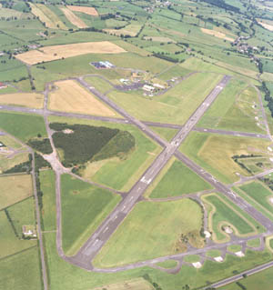 Carlisle Airport is not only commonly referred to as the Lake District Airport but is the most convenient gateway to the South of Scotland.
Finance Manager: A Wallace +44 (0)1228 573641
Marketing Manager: R Gordon +44 (0)28 3026 4435
Cargo Manager: D Johnston +44 (0)1228 573641
Passenger Manager: D Johnston +44 (0)1228 573641
Air Traffic Controller: D E Buck +44 (0)1228 573641
Security Manager: D Johnston +44 (0)1228 573641
Operator: Haughey Airports Ltd
Traffic
1997
Passenger throughput - 885
Cargo handled (tonnes) - 251
Cargo handled (1000s lbs) - 553
Aircraft movements - 29,444
1998
Passenger throughput - 544
Cargo handled (tonnes) - 166
Cargo handled (1000s lbs) - 365
Aircraft movements - 29,973
- International
- Carlisle 10km (6miles)
- Position 54�56'25"N, 002�48'53"W
- Elevation 62m (203ft)
- 1 Passenger Terminal
- 1 Cargo Terminal
- Open 0900 � 1830 / 7 Days a Week
- 1837 / 938m
- Licensed Cafe Bar
- Avgas & Jet Fuel available
- Tower Frequency 123.600 / ATIS 118.425
- Currently there are no scheduled services from or to Carlisle.
Additional Information: Main runway to be relaid winter 2004, ILS to be installed summer 2005, New terminal summer 2006, Main runway to be lengthened winter 2005.
Currently available at Carlisle Airport:
Learn to Fly
Carlisle Flight Training
Tel: 01228 573 344
Border Air Training
Tel: 01228 573 490
Cumbria Microlights & Roger Savage Autogyros
Tel: 01228 526 461
Mob: 07711 064 851
Helicopter Charter:
For all enquiries for Helicopter charter please contact Gae at Heli- Hire:
Tel: 01293 772 033
Fax: 01293 785 552
Carlisle Airport
Haughey Airports Ltd
Carlisle Airport
Carlisle
Cumbria
CA6 4NW
Tel: +44 (0) 1228 573641
Fax: +44 (0) 1228 573310
Email: enquiries at carlisleairport co uk
WWW: http://www.carlisleairport.co.uk/
Images and information placed above are from
http://www.azworldairports.com/cfm/frame.cfm?src= http://www.azworldairports.com/airports/p2720cax.htm
http://www.driversjonas.com/
We thank them for the data!
| General Info
|
| Country |
United Kingdom
|
| ICAO ID |
EGNC
|
| Time |
UTC 0(+1DT)
|
| Latitude |
54.937500
54° 56' 15.00" N
|
| Longitude |
-2.809167
002° 48' 33.00" W
|
| Elevation |
190 feet
58 meters
|
| Type |
Civil
|
| Magnetic Variation |
004° W (01/05)
|
| Operating Agency |
CIVIL GOVERNMENT, (LANDING FEES AND DIPLOMATIC CLEARANCE MAY BE REQUIRED)
|
| Operating Hours |
SEE REMARKS FOR OPERATING HOURS OR COMMUNICATIONS FOR POSSIBLE HOURS
|
| Daylight Savings Time |
Last Sunday in March to last Sunday in October
|
| Communications
|
TWR
Opr 0900-1830Z++ and by arng.
|
123.6
|
ATIS
Opr 0900-1830Z++
|
118.425
|
APP
Opr 0900-1830Z++ and by arng.
|
123.6
|
RDO
By NOTAM.
|
123.6
|
| Runways
|
| ID |
Dimensions |
Surface |
PCN |
ILS
|
| 01/19 |
3077 x 75 feet
938 x 23 meters |
ASPHALT |
- |
NO
|
| 07/25 |
6075 x 98 feet
1852 x 30 meters |
ASPHALT |
029FCXT |
NO
|
13/31
CLOSED |
4057 x 150 feet
1237 x 46 meters |
SURFACE UNKNOWN. |
- |
NO
|
| Supplies/Equipment
|
| Fuel |
Jet A1+, Jet A1 with icing inhibitor.
100/130 MIL Spec, low lead, aviation gasoline (BLUE)
|
| Oil |
O-123, 1065,(Dispersant)Reciprocating Engine Oil(MIL L 22851 Type III)
|
| Remarks
|
| FUEL |
Prior arng rqr. (NC-100LL, A1)
|
| LGT |
PAPI Rwy 07 GS 3.5 MEHT 39', PAPI Rwy 25 GS 3.25 MEHT 30'.
|
| OIL |
O-123
|
| OPR HOURS |
Opr 0900-1830Z++ Mon-Fri; OT by arng.
|
| RSTD |
PPR
|
| RWY |
Rpt LDA: Rwy 01, 2635'; Rwy 19, 2654'; Rwy 07, 4334'; Rwy 25, 4820'.
|
Runway 01/19
3077 x 75 feet
938 x 23 meters
| Runway 01
|
| Surface |
ASPHALT
|
| True Heading |
001.0
|
| Latitude |
54.935000
54° 56' 06.00" N
|
| Longitude |
-2.811389
002° 48' 41.00" W
|
| Elevation |
149.0 feet
45 meters
|
| Landing Distance |
3077 feet
938 meters
|
| Takeoff Distance |
3077 feet
938 meters
|
| Runway 19
|
| Surface |
ASPHALT
|
| True Heading |
181.0
|
| Latitude |
54.943417
54° 56' 36.30" N
|
| Longitude |
-2.811111
002° 48' 40.00" W
|
| Landing Distance |
2654 feet
809 meters
|
| Takeoff Distance |
3077 feet
938 meters
|
| Displaced Threshold Length |
423 feet
129 meters
|
Runway 07/25
6075 x 98 feet
1852 x 30 meters
| Runway 07
|
| Surface |
ASPHALT
|
| True Heading |
060.0
|
| Latitude |
54.933333
54° 56' 00.00" N
|
| Longitude |
-2.821389
002° 49' 17.00" W
|
| Elevation |
142.0 feet
43 meters
|
| Slope |
0.7°
|
| Landing Distance |
4572 feet
1394 meters
|
| Takeoff Distance |
6075 feet
1852 meters
|
| Displaced Threshold Length |
1503 feet
458 meters
|
| Lighting System |
HIRL
PAPI |
| Runway 25
|
| Surface |
ASPHALT
|
| True Heading |
240.0
|
| Latitude |
54.941667
54° 56' 30.00" N
|
| Longitude |
-2.796389
002° 47' 47.00" W
|
| Elevation |
182.0 feet
55 meters
|
| Slope |
-0.7°
|
| Landing Distance |
5271 feet
1607 meters
|
| Takeoff Distance |
6075 feet
1852 meters
|
| Displaced Threshold Length |
804 feet
245 meters
|
| Lighting System |
HIRL
PAPI |
The content above was published at Airports-Worldwide.com in 2005.
We don't guarantee the information is fresh and accurate. The data may be wrong or outdated.
For more up-to-date information please refer to other sources.
|
|


