|
|
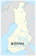
Hämeenkyrö Airfield (ICAO: EFHM) is an airfield in Hämeenkyrö, Finland, about 7 nautical miles (13 km; 8 mi) northwest of Hämeenkyrö centre.
|
Hämeenkyrö Airfield
Hämeenkyrön lentokenttä
|
|
|
| Summary |
| Operator |
Hämeenkyrön Lentokerho ry |
| Location |
Hämeenkyrö, Finland |
| Elevation AMSL |
449 ft / 137 m |
| Coordinates |
61°41′25″N
023°04′27″E |
| Map |
|
|
| Runways |
| Direction |
Length |
Surface |
| m |
ft |
| 07/25 |
950 |
3,117 |
Asphalt |
|
The above content comes from Wikipedia and is published under free licenses – click here to read more.
| General Info
|
| Country |
Finland
|
| ICAO ID |
EFHM
|
| Time |
UTC+2(+3DT)
|
| Latitude |
61.689656
61° 41' 22.76" N
|
| Longitude |
23.073744
023° 04' 25.48" E
|
| Elevation |
449 feet
137 meters
|
| Magnetic Variation |
006° E (01/06)
|
| Operating Agency |
CIVIL GOVERNMENT, (LANDING FEES AND DIPLOMATIC CLEARANCE MAY BE REQUIRED)
|
| Operating Hours |
NO OPERATING HOURS LISTED
|
| Daylight Saving Time |
Last Sunday in March to last Sunday in October
|
| Communications
|
| RDO |
123.15
|
| Runways
|
| ID |
Dimensions |
Surface |
PCN |
ILS
|
| 07/25 |
3000 x 45 feet
914 x 14 meters |
ASPHALT |
- |
NO
|
| Supplies/Equipment
|
| Fuel |
100/130 octane gasoline, leaded, MIL-L-5572F (GREEN)
|
| Remarks
|
| OPR HOURS |
Opr HX.
|
The content above was published at Airports-Worldwide.com in 2020.
We don't guarantee the information is fresh and accurate. The data may be wrong or outdated.
For more up-to-date information please refer to other sources.
|
|