|
|
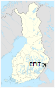
Kitee Airfield (IATA: KTQ, ICAO: EFIT) is an aerodrome in Kitee, Finland.
|
Kitee Airfield
Kiteen lentokenttä
|
|
|
| Summary |
| Airport type |
Public |
| Operator |
Town of Kitee |
| Location |
Kitee, Finland |
| Elevation AMSL |
364 ft / 111 m |
| Coordinates |
62°09′58″N
030°04′25″E |
| Website |
www.kitee.fi/… |
| Map |
|
|
| Runways |
| Direction |
Length |
Surface |
| m |
ft |
| 01/19 |
1,500 |
4,921 |
Asphalt |
|
The above content comes from Wikipedia and is published under free licenses – click here to read more.
| General Info
|
| Country |
Finland
|
| ICAO ID |
EFIT
|
| Time |
UTC+2(+3DT)
|
| Latitude |
62.166111
62° 09' 58.00" N
|
| Longitude |
30.073611
030° 04' 25.00" E
|
| Elevation |
364 feet
111 meters
|
| Magnetic Variation |
009° E (01/06)
|
| Operating Agency |
CIVIL GOVERNMENT, (LANDING FEES AND DIPLOMATIC CLEARANCE MAY BE REQUIRED)
|
| Operating Hours |
NO OPERATING HOURS LISTED
|
| Daylight Saving Time |
Last Sunday in March to last Sunday in October
|
| Communications
|
| RDO |
123.45
|
| Runways
|
| ID |
Dimensions |
Surface |
PCN |
ILS
|
| 01/19 |
4921 x 98 feet
1500 x 30 meters |
ASPHALT |
- |
NO
|
| Remarks
|
| CAUTION |
Glfr act with acft tows and winch launches to 2700' AGL.
|
| OPR HOURS |
Opr HX.
|
The content above was published at Airports-Worldwide.com in 2020.
We don't guarantee the information is fresh and accurate. The data may be wrong or outdated.
For more up-to-date information please refer to other sources.
|
|