|
|
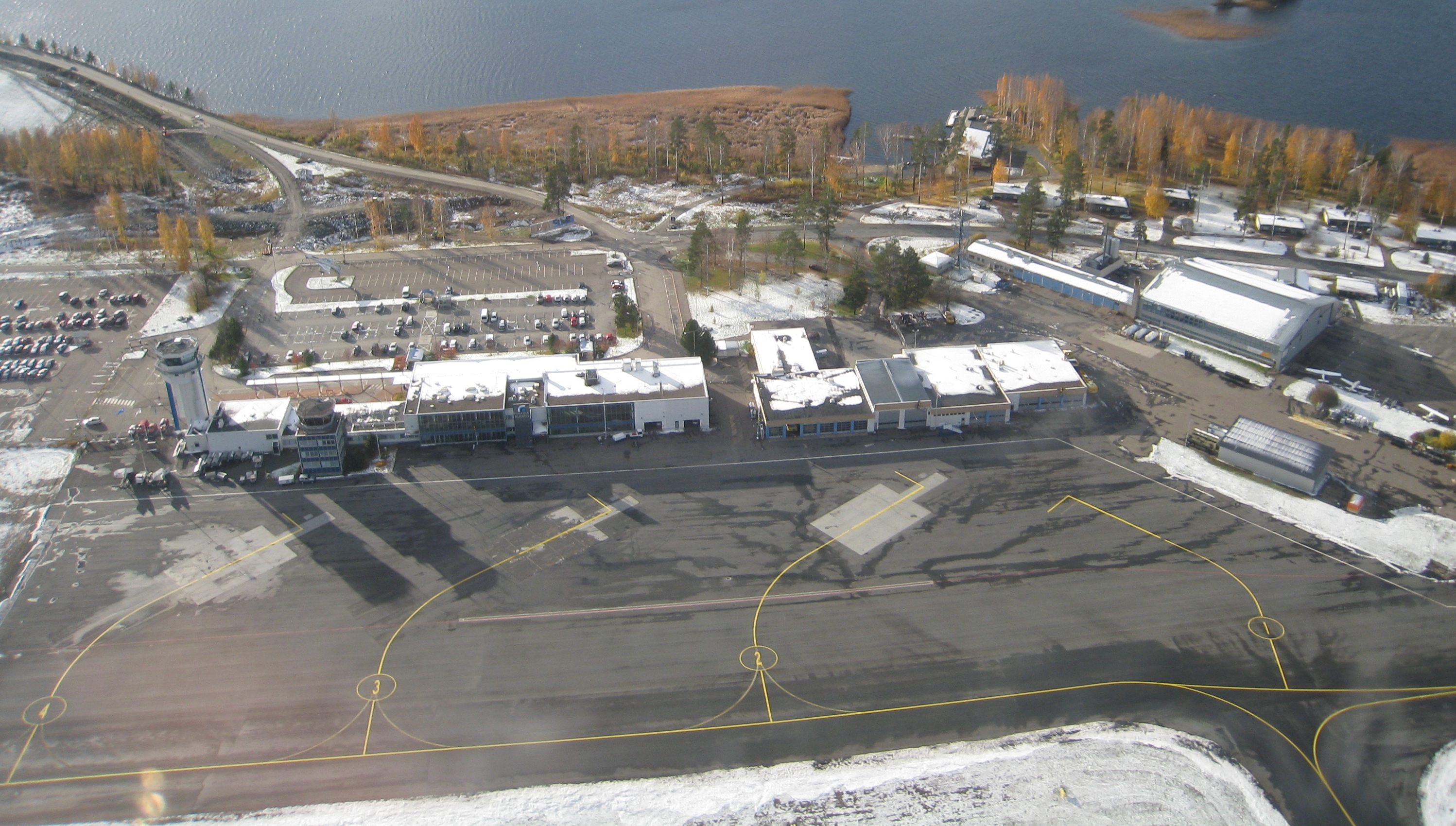
Kuopio Airport (IATA: KUO, ICAO: EFKU) is an airport in Rissala, Finland, about 14 kilometres (9 mi) north of Kuopiocity centre. It is the fifth busiest airport in Finland, as measured by the number of passengers (ca. 235,411 (2017).
|
Kuopio Airport
Kuopion lentoasema
|
|
|
|
| Summary |
| Airport type |
Public / Military |
| Operator |
Finavia |
| Serves |
Kuopio, Finland |
| Location |
Rissala, Finland |
| Elevation AMSL |
323 ft / 98 m |
| Coordinates |
63°00′31″N
027°47′40″E |
| Map |
|
|
| Runways |
| Direction |
Length |
Surface |
| m |
ft |
| 15/33 |
2,800 |
9,186 |
Asphalt |
|
| Statistics (2017) |
| Passengers |
235,411 |
| Landings |
2,023 |
|
History
Kuopio Airport was completed in November 1939 and flight operations started in May 1940. It was used by the Luftwaffeduring World War II (1942–43). During the Continuation War the runways were made from plywood. The first terminal building was opened in 1949 before a new one replaced it in 1971. In 2004, Kuopio Airport was chosen as the Airport of the Year in Finland. As of 2006, Kuopio Airport was one of only five profitable airports in Finland, thanks to shared use of the runways by the Karelian Air Command of the Finnish Air Force and civilian airlines. Kuopio had its first international scheduled route when AirBaltic operated direct flights to Riga in 2008–2011.
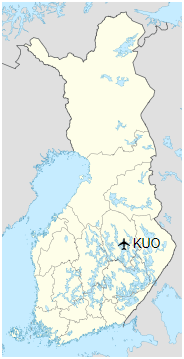
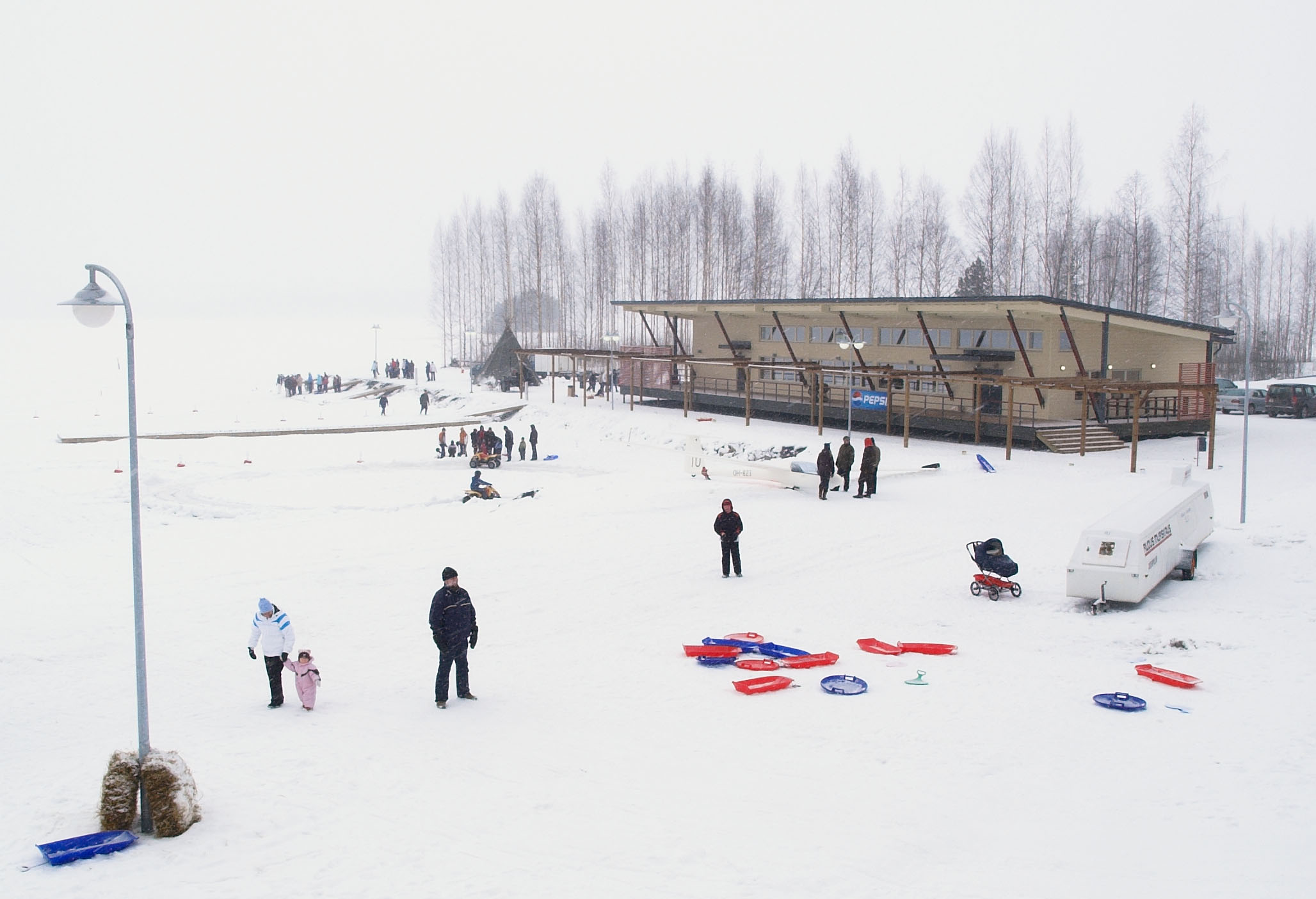
Lake terminal
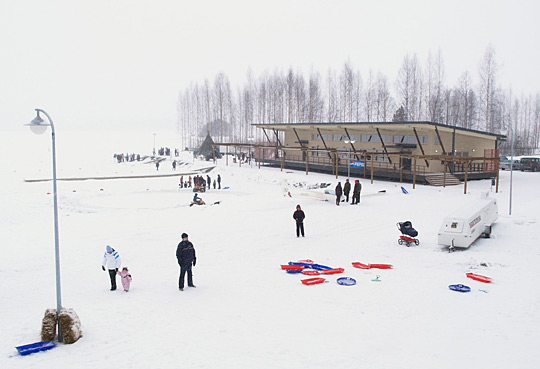
Lake terminal
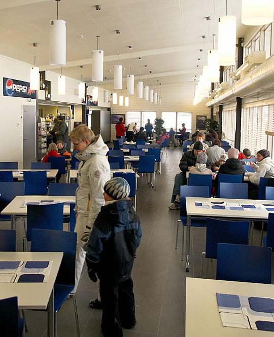
Lake terminal interior
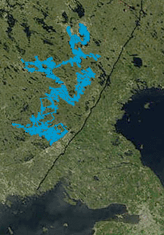
Lake Saimaa highlighted
A unique airport Lake terminal was completed in March 2008. The terminal is situated some 200 metres (660 ft) from the airport tower. It connects the airport to Lake Saimaa region.
Lake Saimaa offers a waterway connection to the cities of the Finnish Lakeland: Imatra, Joensuu, Kuopio, Lappeenranta, Mikkeli, Savonlinna and Varkaus. Vuoksi River flows from Saimaa to Lake Ladoga (Russia). Saimaa Canal connects Saimaa with the Gulf of Finland.
Airlines and destinations
| Destinations |
| Finnair |
Helsinki |
| Thomas Cook Airlines Scandinavia |
Seasonal: Gran Canaria |
Accidents and incidents
- On 3 October 1978, Douglas C-47A DO-10 of the Finnish Air Force crashed into Lake Juurusvesi when attempting to return to Kuopio Airport. The aircraft was on a military flight to Helsinki Airport when an engine failed shortly after take-off and the decision was made to return to Kuopio.
Finnish Air Force
Kuopio Airport is also home of the Finnish Air Force’s Karelian Air Command and the Fighter Squadron 31 (HävLLv 31).
Statistics
Annual passenger statistics for Kuopio Airport
| Year |
Domestic passengers |
International passengers |
Total passengers |
Change |
| 2005 |
274,954 |
32,785 |
307,739 |
+6.5% |
| 2006 |
289,231 |
42,971 |
332,202 |
+7.9% |
| 2007 |
270,430 |
33,774 |
304,204 |
−8.4% |
| 2008 |
252,616 |
37,601 |
290,247 |
−4.6% |
| 2009 |
220,018 |
30,546 |
250,564 |
−13.7% |
| 2010 |
207,067 |
46,545 |
253,612 |
+1.2% |
| 2011 |
244,472 |
39,933 |
284,405 |
+12.1% |
| 2014 |
221,722 |
38,642 |
260,364 |
-0.3% |
| 2015 |
202,041 |
30,226 |
232,267 |
-10.8% |
| 2016 |
200,569 |
26,625 |
227,194 |
-2.2% |
| 2017 |
207,276 |
28,135 |
235,411 |
+3.6% |
Ground transportation
| Means of transport at Kuopio Airport |
| Means of transport |
Operator |
Route |
Destinations |
Website |
Notes |
| Bus |
Kuopio Public Transport |
40 |
Market Square (Finnish: Kauppatori) |
joukkoliikenne.kuopio.fi |
Every hour on weekdays |
| Taxi |
Savon Taksidata |
Airport Taxi |
Kuopio |
www.savontaksidata.fi |
According to flight schedules |
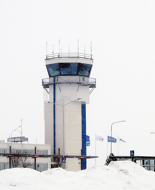
The new Air Traffic Control tower
The above content comes from Wikipedia and is published under free licenses – click here to read more.
| General Info
|
| Country |
Finland
|
| ICAO ID |
EFKU
|
| Time |
UTC+2(+3DT)
|
| Latitude |
63.007150
63° 00' 25.74" N
|
| Longitude |
27.797756
027° 47' 51.92" E
|
| Elevation |
323 feet
98 meters
|
| Type |
Civil
|
| Magnetic Variation |
009° E (01/06)
|
| Operating Agency |
CIVIL GOVERNMENT, (LANDING FEES AND DIPLOMATIC CLEARANCE MAY BE REQUIRED)
|
| Communications
|
TWR
Opr H24.
|
120.15
119.7
|
ATIS
Opr H24.
|
113.0
|
| APP |
130.6
119.7
|
| Runways
|
| ID |
Dimensions |
Surface |
PCN |
ILS
|
06/24
CLOSED |
4921 x 148 feet
1500 x 45 meters |
ASPHALT |
- |
NO
|
| 15/33 |
9186 x 197 feet
2800 x 60 meters |
ASPHALT |
045FAWT |
YES
|
| Navaids
|
| Type |
ID |
Name |
Channel |
Freq |
Distance From Field |
Bearing From Navaid
|
| VOR-DME |
VEH |
VEHKAA |
077X |
113 |
1.7 NM |
338.0
|
| NDB |
KUR |
KURKI |
- |
310 |
5.5 NM |
328.3
|
| Supplies/Equipment
|
| Fuel |
Jet A1, without icing nhibitor.
100/130 MIL Spec, low lead, aviation gasoline (BLUE)
|
| Other Fluids |
DE-ICE, Anti-icing/De-icing/Defrosting Fluid (MIL A 8243)
|
| Remarks
|
| CSTMS/IMG |
CSTMS avbl HO, 1.5 hr PN btn 0600-1415Z++ Mon-Fri; IMG avbl HO.
|
| FLUID |
De-Ice
|
| FUEL |
Avbl 0400-2000Z++ dly, OT 1 hr PN. (NC-100LL, A1)
|
| MISC |
Ldg fees.
|
| OPR HOURS |
Opr HO.
|
| RSTD |
Rwy 06-24 clsd UFN.
|
The content above was published at Airports-Worldwide.com in 2020.
We don't guarantee the information is fresh and accurate. The data may be wrong or outdated.
For more up-to-date information please refer to other sources.
|
|