|
|
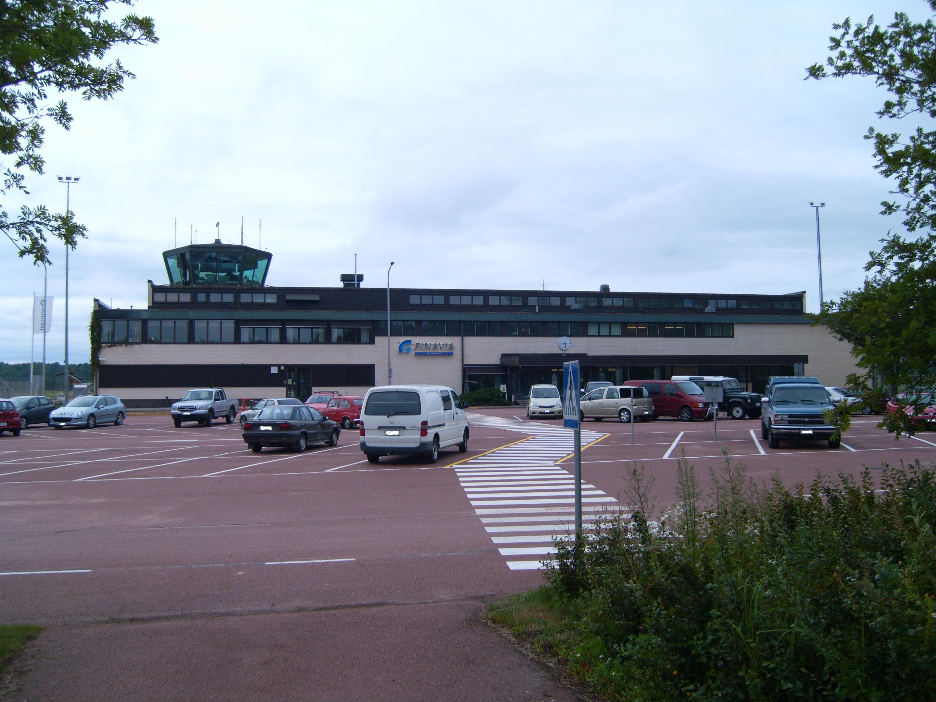
Mariehamn Airport (Swedish: Mariehamns flygplats, Finnish: Maarianhaminan lentoasema) (IATA: MHQ, ICAO: EFMA) is located in Jomala, Åland (a territory of Finland). The airport is located some 3 kilometres (2 mi) north-west of Mariehamn town centre. It served 61,568 passengers in 2017 and is operated by the state-owned Finavia.
The airport has a duty-free shop. Passengers can buy goods, e.g. alcohol, without VAT and other taxes. This is allowed before flying to any destination outside Åland, even to Finland. Normally local taxes must be paid in airport shops before travelling inside the EU, but Åland is outside the EU VAT area, for the very reason to allow tax-free sales onboard ferries and at the airport. Åland is in other respects a part of the EU.
The Aero Flight 217 aviation accident that resulted in 22 deaths occurred near the airport in 1963.
|
Mariehamn Airport
Mariehamns flygplats
Maarianhaminan lentoasema
|
|
|
|
| Summary |
| Airport type |
Public |
| Owner |
Finavia |
| Serves |
Mariehamn |
| Location |
Jomala, Åland, Finland |
| Elevation AMSL |
17 ft / 5 m |
| Coordinates |
60°07′19″N
019°53′47″E |
| Website |
https://www.finavia.fi/en/mariehamn/ |
| Map |
|
|
| Runways |
| Direction |
Length |
Surface |
| m |
ft |
| 03/21 |
1,903 |
6,243 |
Asphalt |
|
| Statistics (2018) |
| Passengers |
54,640 |
| Landings |
1,389 |
|
Airlines and destinations
| Destinations |
| Air Leap |
Stockholm-Arlanda (PSO), Turku (PSO) |
| Finnair |
Helsinki, Turku |
Statistics
Annual passenger statistics for Mariehamn Airport
| Year |
Domestic passengers |
International passengers |
Total passengers |
Change |
| 2005 |
43,266 |
4,079 |
47,345 |
−18.9% |
| 2006 |
57,364 |
6,750 |
64,114 |
+35.4% |
| 2007 |
53,269 |
10,032 |
63,301 |
−1.3% |
| 2008 |
51,210 |
10,900 |
62,110 |
−1.9% |
| 2009 |
41,949 |
14,305 |
56,254 |
−9.4% |
| 2010 |
36,904 |
11,768 |
48,672 |
−13.5% |
| 2011 |
39,209 |
14,359 |
53,568 |
+10.1% |
| 2014 |
37,436 |
14,661 |
52,097 |
-0.8% |
| 2015 |
42,365 |
16,971 |
59,336 |
+13.9% |
| 2016 |
42,864 |
16,680 |
59,544 |
+0.4% |
| 2017 |
42,488 |
19,080 |
61,568 |
+3.4% |
| 2018 |
41,377 |
13,263 |
54,640 |
-11.3% |
The above content comes from Wikipedia and is published under free licenses – click here to read more.
| General Info
|
| Country |
Finland
|
| ICAO ID |
EFMA
|
| Time |
UTC+2(+3DT)
|
| Latitude |
60.122203
60° 07' 19.93" N
|
| Longitude |
19.898156
019° 53' 53.36" E
|
| Elevation |
17 feet
5 meters
|
| Type |
Civil
|
| Magnetic Variation |
005° E (01/06)
|
| Operating Agency |
CIVIL GOVERNMENT, (LANDING FEES AND DIPLOMATIC CLEARANCE MAY BE REQUIRED)
|
| Alternate Name |
ALAND ISLAND
|
| Island Group |
Aland I
|
| International Clearance Status |
Airport of Entry
|
| Daylight Saving Time |
Last Sunday in March to last Sunday in October
|
| Communications
|
| TWR |
119.6
119.7
|
ATIS
Opr H24.
|
114.7
|
| Runways
|
| ID |
Dimensions |
Surface |
PCN |
ILS
|
| 03/21 |
6243 x 197 feet
1903 x 60 meters |
ASPHALT |
040FAXT |
YES
|
| Navaids
|
| Type |
ID |
Name |
Channel |
Freq |
Distance From Field |
Bearing From Navaid
|
| VOR-DME |
MAR |
MARIE |
094X |
114.7 |
1.2 NM |
198.9
|
| Supplies/Equipment
|
| Fuel |
Jet A1, without icing nhibitor.
100/130 MIL Spec, low lead, aviation gasoline (BLUE)
|
| Remarks
|
| FLUID |
De-Ice O/R.
|
| FUEL |
1 hr PN rqr. (NC-100LL, A1)
|
| LGT |
PAPI Rwy 03 GS 3.9 , PAPI Rwy 21 GS 3.5 .
|
| MISC |
Class D airspace eff twr hr, OT Class G.
|
| OPR HOURS |
Opr HO.
|
The content above was published at Airports-Worldwide.com in 2020.
We don't guarantee the information is fresh and accurate. The data may be wrong or outdated.
For more up-to-date information please refer to other sources.
|
|