|
 |
|
||||
|
Cherbourg – Maupertus Airport or Aéroport de Cherbourg - Maupertus (IATA: CER, ICAO: LFRC) is an airport located 11 km east of Cherbourg-Octeville, between Maupertus-sur-Mer and Gonneville. These are all communes of the Manche département in the Basse-Normandie région of France. The airport is managed by SNC-Lavalin Airports (subsidiary of the large Canadian engineering firm SNC-Lavalin) since 1st october 2009. It has one runway, Runway 10/28. It is 2440 metres long and is covered in asphalt. There are six bays, numbered N1 to N6. There are currently no scheduled flights operating to or from the airport. Until early 2008 there was one scheduled flight a day from Paris to Jersey via Cherbourg although this has now been withdrawn. Charter flights occasionally operate to and from the airport. Airlines and destinationsCharter Services
HistoryThe airport was originally built by the United States Army Air Force during World War II shortly after the D-Day Normandy Invasion as a temporary airfield between 24 July and 17 August 1944. The airfield was constructed by the IX Engineer Command, 850th Engineer Aviation Battalion and 877th Airborne Engineer Aviation Battalion. Known as Advanced Landing Ground "A-15", the airfield consisted of a 6000' (1800m) Pierced Steel Planking (PSP) runway aligned 11/29. A secondary PSP 5000' (1500m) runway was also laid down aligned 17/35. In addition, tents were used for billeting and also for support facilities; an access road was built to the existing road infrastructure; a dump for supplies, ammunition, and gasoline drums, along with a drinkable water and minimal electrical grid for communications and station lighting. The 363d Fighter Group, based P-38 Lightning fighters at Maupertus from 9 July through August 1944. They were replaced on 22 August by the B-26 Marauder-equipped 387th Bombardment Group until 18 September 1944. In addition to the bombers, Maupertus was used as an air defense field by the 422d Night Fighter Squadron, flying P-61 Black Widow interceptors until the end of August 1944. The fighter planes flew support missions during the Allied invasion of Normandy, patrolling roads in front of the beachhead; strafing German military vehicles and dropping bombs on gun emplacements, anti-aircraft artillery and concentrations of German troops in Normandy and Brittany when spotted. The bombers also attacked bridges and German-controlled airfields in occupied areas. After the Americans moved east into Central France with the advancing Allied Armies, the airfield was used as a resupply and causality evacuation airfield for several months, before being closed on 22 December 1944. It was then turned over to French authorities. In the 1950s, a modern concrete jet runway for NATO aircraft was laid down by the United States using French contractors, along with a circular marguerite system of dispersal hardstands that could be revetted later with earth for added protection. The Cold War air base was never used and was abandoned when France pulled out of the NATO central command structure in 1967. The remains of the World War II main (11/29) runway are still visible just to the south of the current airport runway. Also a part of the secondary runway was reused as a taxiway to the now aircraft parking area to the south of the runway. The Cold War-era marguerite hardstands appear to be well-maintained, their use being undetermined.
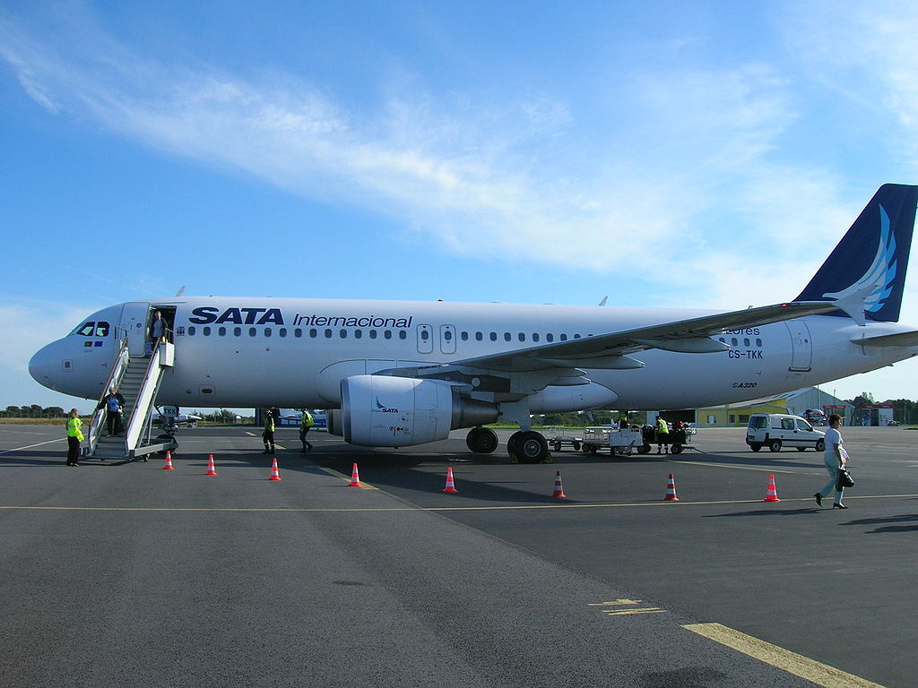
Maupertus Airport - Airbus A320 de la SATA Air Açores en provenance de Lisbonne, sur le tarmac de Maupertus, le 23 septembre 2006 The above content comes from Wikipedia and is published under free licenses – click here to read more.
The content above was published at Airports-Worldwide.com in 2010. |
|||||||||||||||||||||||||||||||||||||||||||||||||||||||||||||||||||||||||||||||||||||||||||||||||||||||||||||||||||||||||||||||||||||||||||||||||||||||||||||

 |
|
Copyright 2004-2026 © by Airports-Worldwide.com, Vyshenskoho st. 36, Lviv 79010, Ukraine Legal Disclaimer |