Saint-Georges-de-l'Oyapock Airport |
Saint-Georges-de-l’Oyapock Airport (IATA: OYP, ICAO: SOOG) is an airport serving Saint-Georges (also known as Saint-Georges-de-l’Oyapock) in French Guiana. Saint-Georges lies on the Oyapock River, which forms the border between French Guiana and Brazil.
The Saint Georges non-directional beacon (Ident: GOP) is located on the field.
|
St-Georges-de-l’Oyapock Airport
|
|
|
| Summary |
| Airport type |
Public |
| Operator |
Conseil général de la Guyane |
| Serves |
St-Georges-de-l’Oyapock, French Guiana |
| Elevation AMSL |
36 ft / 11 m |
| Coordinates |
3°53′50″N
51°48′15″W |
| Map |
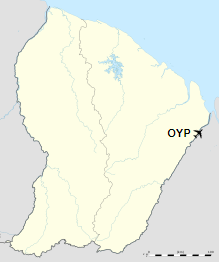
Location in French Guiana
|
| Runways |
| Direction |
Length |
Surface |
| m |
ft |
| 04/22 |
1,200 |
3,937 |
Asphalt |
|
The above content comes from Wikipedia and is published under free licenses – click here to read more.
| General Info
|
| Country |
French Guiana
|
| ICAO ID |
SOOG
|
| Time |
UTC-4
|
| Latitude |
3.897600
03° 53' 51.36" N
|
| Longitude |
-51.804083
051° 48' 14.70" W
|
| Elevation |
46 feet
14 meters
|
| Magnetic Variation |
018° W (01/06)
|
| Operating Agency |
CIVIL GOVERNMENT, (LANDING FEES AND DIPLOMATIC CLEARANCE MAY BE REQUIRED)
|
| Operating Hours |
SUNRISE TO SUNSET (SR-SS)
|
| Communications
|
| OIAPOQUE AFIS |
125.9
|
| Runways
|
| ID |
Dimensions |
Surface |
PCN |
ILS
|
| 04/22 |
3937 x 49 feet
1200 x 15 meters |
CONCRETE. |
- |
NO
|
| Navaids
|
| Type |
ID |
Name |
Channel |
Freq |
Distance From Field |
Bearing From Navaid
|
| NDB |
OIA |
OIAPOQUE |
- |
340 |
2.3 NM |
008.5
|
| Remarks
|
| OPR HOURS |
Opr SR-SS.
|
| RSTD |
PPR. Avoid overflying Oiapoque river.
|
The content above was published at Airports-Worldwide.com in 2020.
We don't guarantee the information is fresh and accurate. The data may be wrong or outdated.
For more up-to-date information please refer to other sources.
|