 |
|
| Kopitnari Airport |
 |
| IATA: KUT – ICAO: UGKO |
| Summary |
| Airport type |
Public |
| Serves |
Kutaisi, Georgia |
| Elevation AMSL |
223 ft / 68 m |
| Coordinates |
42°10′35″N 042°28′57″E / 42.17639°N 42.4825°E / 42.17639; 42.4825 |
| Runways |
| Direction |
Length |
Surface |
| m |
ft |
| 08/26 |
2,500 |
8,202 |
Concrete |
| Source: DAFIF |
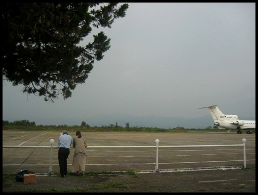
Kopitnari Airport (IATA: KUT, ICAO: UGKO) is an airport located 14 km (8.7 mi) west of Kutaisi, the second largest city in Georgia and capital of the western region of Imereti. It is one of three international airports currently in operation in Georgia.
Airlines and destinations
| Airlines |
Destinations |
| Aerosvit |
Kiev-Boryspil |
| Georgian International Airlines |
Cologne/Bonn, Donetsk, Kharkiv, Tehran-Imam Khomeini |
| Wind Rose Aviation |
Kiev-Boryspil |
The above content comes from Wikipedia and is published under free licenses – click here to read more.
| General Info
|
| Country |
Georgia
|
| ICAO ID |
UGKO
|
| Time |
UTC+3(+4DT)
|
| Latitude |
42.176653
42° 10' 35.95" N
|
| Longitude |
42.482583
042° 28' 57.30" E
|
| Elevation |
223 feet
68 meters
|
| Type |
Civil
|
| Magnetic Variation |
005° E (01/06)
|
| Operating Agency |
CIVIL GOVERNMENT, (LANDING FEES AND DIPLOMATIC CLEARANCE MAY BE REQUIRED)
|
| Near City |
KUTAISI
|
| Operating Hours |
SEE REMARKS FOR OPERATING HOURS OR COMMUNICATIONS FOR POSSIBLE HOURS
|
| Daylight Saving Time |
Last Sunday in March to last Sunday in October
|
| Communications
|
KUTAISI TWR
0400-1600Z++
|
125.5
|
| Runways
|
| ID |
Dimensions |
Surface |
PCN |
ILS
|
| 08/26 |
8202 x 144 feet
2500 x 44 meters |
CONCRETE. |
026RCYT |
NO
|
| Navaids
|
| Type |
ID |
Name |
Channel |
Freq |
Distance From Field |
Bearing From Navaid
|
| VOR-DME |
KTS |
KUTAISI |
083X |
113.6 |
1.2 NM |
075.2
|
| NDB |
UY |
KUTAISI |
- |
842 |
2.8 NM |
254.5
|
| Remarks
|
| FLUID |
OX
|
| FUEL |
(NC-TS1)
|
| LGT |
Rwy lgt may be inop.
|
| OIL |
MK-8P
|
| OPR HOURS |
Opr 0400-1600Z++ OT PPR 12 Hr before Dep.
|
The content above was published at Airports-Worldwide.com in 2010.
We don't guarantee the information is fresh and accurate. The data may be wrong or outdated.
For more up-to-date information please refer to other sources.
|
 |


