 |
|
 |
 |
 |
 |

Following the recent introduction of a fully revised Scale of Charges, Gloucestershire Airport has seen a dramatic upsurge in traffic. May was the Airport’s busiest month for over 15 years, with over 10 200 movements, and June is already on target to beat it.
Feedback from customers has been positive, and some further suggestions have warranted more changes to the charging scheme: -
Parking
Visiting aircraft receive 4 hours free parking, but a new ‘same day departure’ rate of ?5 +VAT has been introduced for aircraft up to 3mt, enabling visitors to venture further afield and sample what the surrounding area has to offer.
Helicopter Jet A1 Refuelling
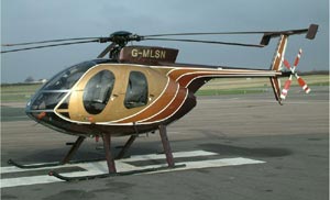
 Helicopters up to 3mt buying 200 litres or more of Jet A1, now pay only £15 +VAT. Refuelling is available for shut down or rotors turning refuel, without prior notification 7 days per week.
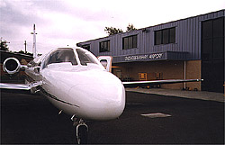
With six hard runways, a new grass runway in the process of being prepared, full ATC with NDB, DME, Radar, runway lighting and fire cover seven days per week, Gloucestershire Airport is undoubtedly one of the best equipped GA Airports in the country. Gloucestershire Airport is also home to the new Transair Pilot Shop, The Aviator restaurant and no less than 6 Flying Training Organisations, providing every conceivable level of pilot training from NPPL to Instrument Rating. Allied with full, on-site maintenance facilities, avionics, fuel, hangarage and its prime location in the heart of the Cotswolds, a short taxi ride from Cheltenham or Gloucester, it truly has an enormous amount to offer.
Perhaps the ideal time to visit will be during this year’s PFA Rally at Kemble, when landing fees will be waived for all visiting aircraft refuelling at Gloucestershire Airport, en route to or from the Rally. The sheer volume of traffic attending the Rally inevitably leads to some delays for fuel, but the short hop across the Cotswolds could help to relieve the pressure and allow pilots to sample what Gloucestershire Airport has to offer.
History of the Gloucestershire Aviation Museum
The Gloucestershire Aviation Collection GAC which is a registered charity was formed over ten years ago with the main objective of establishing a museum in Gloucestershire to celebrate the County's outstanding aerospace heritage.
The Jetage Museum already has a significant collection of aircraft and other artefacts stored at several locations, the bulk of which is in temporary storage at Staverton Airport whilst the Museum relocates to new premises.
The new Jet Age museum will mark the history of the site in a significant way with a special feature being the development of jet flight and the work of Sir Frank Whittle.
In addition the Collection will embrace all aerospace in Gloucestershire past and present. It will not just be a collection of Gloster aircraft but will include all aviation heritage from the historic county of Gloucestershire. Messier Dowty and Smiths Industries are just two of the local companies which continue to demonstrate the still active aerospace industry of the County.
 Gloucestershire Airport Limited
Staverton,
Cheltenham,
Gloucestershire
GL51 6SR
Telephone: 01452 857700
Facsimile: 01452 714593
E-mail: lbexson at gloucestershireairport co uk
WWW: http://www.gloucestershireairport.co.uk/
Images and information placed above are from
http://www.jetagemuseum.org/
http://www.gloster.pwp.blueyonder.co.uk/main.htm
We thank them for the data!
| General Info
|
| Country |
United Kingdom
|
| ICAO ID |
EGBJ
|
| Time |
UTC 0(+1DT)
|
| Latitude |
51.894167
51° 53' 39.00" N
|
| Longitude |
-2.167222
002° 10' 02.00" W
|
| Elevation |
101 feet
31 meters
|
| Type |
Civil
|
| Magnetic Variation |
003° W (01/05)
|
| Beacon |
Yes
|
| Operating Agency |
CIVIL GOVERNMENT, (LANDING FEES AND DIPLOMATIC CLEARANCE MAY BE REQUIRED)
|
| Near City |
Gloucester/Cheltenham
|
| Operating Hours |
SEE REMARKS FOR OPERATING HOURS OR COMMUNICATIONS FOR POSSIBLE HOURS
|
| Daylight Savings Time |
Last Sunday in March to last Sunday in October
|
| Communications
|
| GLOSTER TWR |
122.9
|
RADAR
By arng.
|
120.975
|
| FIRE |
121.6
|
| ATIS |
127.475
|
| GLOSTER APP |
128.55
|
| Runways
|
| ID |
Dimensions |
Surface |
PCN |
ILS
|
| 04/22 |
3218 x 112 feet
981 x 34 meters |
ASPHALT |
- |
NO
|
| 09/27 |
4656 x 112 feet
1419 x 34 meters |
ASPHALT |
- |
NO
|
| 18/36 |
2625 x 59 feet
800 x 18 meters |
ASPHALT |
- |
NO
|
| Navaids
|
| Type |
ID |
Name |
Channel |
Freq |
Distance From Field |
Bearing From Navaid
|
| NDB |
GST |
GLOUCESTERSHIRE |
- |
331 |
At Field |
-
|
| Supplies/Equipment
|
| Fuel |
Jet A1, without icing nhibitor.
100/130 MIL Spec, low lead, aviation gasoline (BLUE)
|
| Oil |
Available (Types unknown)
|
| Remarks
|
| CSTMS/IMG |
Ltd CSTMS.
|
| FUEL |
(NC-100LL, A1)
|
| LGT |
ABn, green coded GO. Rwy 04 APAPI GS 4.5 MEHT 20'; Rwy 22 APAPI GS 3.5 MEHT 23'; Rwy 27 rgt PAPI GS 5.3 MEHT 20' and lt PAPI GS 3.5 MEHT 21'; Rwy 09 rgt PAPI GS 5.3 MEHT 15' and lt PAPI MEHT 42'.
|
| MISC |
PPR for inst trng.
|
| OIL |
0-117-123-125
|
| OPR HOURS |
Opr 0830-1930Z++ Mon-Fri; 0900-1800Z (0800-1830Z sum) Sat, Sun. OT by arng.
|
| RSTD |
NORDO proh. Rpt LDA Rwy 09 3783' Rwy 27 3271'.
|
Runway 04/22
3218 x 112 feet
981 x 34 meters
| Runway 04
|
| Surface |
ASPHALT
|
| True Heading |
035.0
|
| Latitude |
51.888606
51° 53' 18.98" N
|
| Longitude |
-2.168133
002° 10' 05.28" W
|
| Elevation |
83.0 feet
25 meters
|
| Slope |
0.1°
|
| Landing Distance |
3218 feet
981 meters
|
| Takeoff Distance |
3218 feet
981 meters
|
| Lighting System |
PAPI
|
| Runway 22
|
| Surface |
ASPHALT
|
| True Heading |
215.0
|
| Latitude |
51.895878
51° 53' 45.16" N
|
| Longitude |
-2.160081
002° 09' 36.29" W
|
| Elevation |
86.0 feet
26 meters
|
| Slope |
-0.1°
|
| Landing Distance |
2929 feet
893 meters
|
| Takeoff Distance |
3218 feet
981 meters
|
| Displaced Threshold Length |
289 feet
88 meters
|
| Lighting System |
PAPI
|
Runway 09/27
4656 x 112 feet
1419 x 34 meters
| Runway 09
|
| Surface |
ASPHALT
|
| True Heading |
085.0
|
| Latitude |
51.893611
51° 53' 37.00" N
|
| Longitude |
-2.177222
002° 10' 38.00" W
|
| Elevation |
73.0 feet
22 meters
|
| Slope |
0.3°
|
| Landing Distance |
4269 feet
1301 meters
|
| Takeoff Distance |
4656 feet
1419 meters
|
| Displaced Threshold Length |
387 feet
118 meters
|
| Lighting System |
HIRL
BO
PAPI |
| Runway 27
|
| Surface |
ASPHALT
|
| True Heading |
265.0
|
| Latitude |
51.894736
51° 53' 41.05" N
|
| Longitude |
-2.156689
002° 09' 24.08" W
|
| Elevation |
88.0 feet
27 meters
|
| Slope |
-0.3°
|
| Landing Distance |
3632 feet
1107 meters
|
| Takeoff Distance |
4656 feet
1419 meters
|
| Displaced Threshold Length |
1024 feet
312 meters
|
| Lighting System |
HIRL
BO
PAPI |
Runway 18/36
2625 x 59 feet
800 x 18 meters
| Runway 18
|
| Surface |
ASPHALT
|
| True Heading |
174.0
|
| Latitude |
51.896667
51° 53' 48.00" N
|
| Longitude |
-2.166111
002° 09' 58.00" W
|
| Elevation |
81.0 feet
25 meters
|
| Slope |
0.3°
|
| Landing Distance |
2625 feet
800 meters
|
| Takeoff Distance |
2625 feet
800 meters
|
| Runway 36
|
| Surface |
ASPHALT
|
| True Heading |
354.0
|
| Latitude |
51.889722
51° 53' 23.00" N
|
| Longitude |
-2.165000
002° 09' 54.00" W
|
| Elevation |
88.0 feet
27 meters
|
| Slope |
-0.3°
|
| Landing Distance |
2625 feet
800 meters
|
| Takeoff Distance |
2625 feet
800 meters
|
Navaids
| GLOUCESTERSHIRE
|
| Type |
ID |
Channel |
Freq |
Country |
State
|
| NDB |
GST |
- |
331 |
United Kingdom |
-
|
| Latitude |
Longitude |
Airport
|
51.891958
51° 53' 31.05" N |
-2.167903
002° 10' 04.45" W |
EGBJ
|
The content above was published at Airports-Worldwide.com in 2005.
We don't guarantee the information is fresh and accurate. The data may be wrong or outdated.
For more up-to-date information please refer to other sources.
|
 |


