 |
 |
|
||||
|
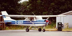
Haverfordwest Airport (HAW/EGFE) Haverfordwest airport is located on the northern outskirts of Haverfordwest town, close to the village of Withybush. The airport is owned, managed and operated by Pembrokeshire County Council and comes under the direction of the Development Directorate. The Ministry of Defence established the airfield in 1941 and was used by RAF. 17 Grp. Coastal CMU. However, operations did not last very long and at the end of the war, the airfield was closed. Small scale operations survived at the airport in the form of flying club activity and small scale private flying but by 1947, formal activities at the airport ceased. The 1990s saw an expansion of operations at the airport. A new operations room was constructed in 1990, a second hangar erected in 1996 and airport movements had increased to around 10,000 per year (higher than now), significantly more than the 1,000 per year achieved during the early 1970s. The airports profile was raised in 1996 when it played a pivotal role as a base airport in the clean up of the Sea Empress disaster of the south west coast of Wales.
Customs - Op. Hours: By arrangement only Contact: ATC Passenger Facilities: 50 short term parking spaces, 50 long term parking spaces. Haverfordwest Airport owned and operated by Pembrokeshire
County Council. Fax. 00 44 ( 0 ) 1437 769246 E-mail: hwest airport at pembrokeshire gov uk Images and information placed above are from http://www.abergwaun.com/places/withybush/ We thank them for the data!
Runway 03/215000 x 148 feet
|
|||||||||||||||||||||||||||||||||||||||||||||||||||||||||||||||||||||||||||||||||||||||||||||||||||||||||||||||||||||||||||||||||||||||||||||||||||||||||||||||||||||||||||||||||||||||||||||||||||||||||||||||||||||||||||||||||||||||||||||||||||||||||||||||||||||||
| Runway 03 | |
|---|---|
| Surface | ASPHALT |
| True Heading | 030.0 |
| Latitude | 51.827094 51° 49' 37.54" N |
| Longitude | -4.966642 004° 57' 59.91" W |
| Elevation | 0.0 feet 0 meters |
| Landing Distance | 4255 feet 1297 meters |
| Takeoff Distance | 5000 feet 1524 meters |
| Displaced Threshold Length | 745 feet 227 meters |
| Lighting System | LIRL
PAPI |
| Runway 21 | |
|---|---|
| Surface | ASPHALT |
| True Heading | 210.0 |
| Latitude | 51.838992 51° 50' 20.37" N |
| Longitude | -4.955683 004° 57' 20.46" W |
| Elevation | 0.0 feet 0 meters |
| Landing Distance | 4163 feet 1269 meters |
| Takeoff Distance | 5000 feet 1524 meters |
| Displaced Threshold Length | 837 feet 255 meters |
| Lighting System | LIRL
PAPI |
| Runway 09 | |
|---|---|
| Surface | ASPHALT |
| True Heading | 088.0 |
| Latitude | 51.833889 51° 50' 02.00" N |
| Longitude | -4.970278 004° 58' 13.00" W |
| Elevation | 0.0 feet 0 meters |
| Slope | 4.0° |
| Landing Distance | 2625 feet 800 meters |
| Takeoff Distance | 3412 feet 1040 meters |
| Displaced Threshold Length | 787 feet 240 meters |
| Runway 27 | |
|---|---|
| Surface | ASPHALT |
| True Heading | 268.0 |
| Latitude | 51.834167 51° 50' 03.00" N |
| Longitude | -4.955278 004° 57' 19.00" W |
| Elevation | 136.0 feet 41 meters |
| Slope | -4.0° |
| Landing Distance | 2723 feet 830 meters |
| Takeoff Distance | 3412 feet 1040 meters |
| Displaced Threshold Length | 689 feet 210 meters |
| HAVERFORDWEST | |||||
|---|---|---|---|---|---|
| Type | ID | Channel | Freq | Country | State |
| NDB | HAV | - | 328 | United Kingdom | - |
| Latitude | Longitude | Airport |
| 51.831878 51° 49' 54.76" N |
-4.968089 004° 58' 05.12" W |
EGFE |
| HAVERFORDWEST | |||||
|---|---|---|---|---|---|
| Type | ID | Channel | Freq | Country | State |
| DME | HDW | 114Y | - | United Kingdom | - |
| Latitude | Longitude | Airport |
| 51.832006 51° 49' 55.22" N |
-4.970117 004° 58' 12.42" W |
EGFE |
The content above was published at Airports-Worldwide.com in 2005.
We don't guarantee the information is fresh and accurate. The data may be wrong or outdated.
For more up-to-date information please refer to other sources.

 |
|
Copyright 2004-2026 © by Airports-Worldwide.com, Vyshenskoho st. 36, Lviv 79010, Ukraine Legal Disclaimer |
 Withybush airport north of Haverfordwest is an important sub-regional aerodrome facility used on a regular basis by light aircraft and helicopters. Although it has the capacity to accommodate significantly larger aircraft it would need to become an approved air traffic control aerodrome to handle scheduled flights.
 Airfield Data: 2 Runways, Fire Category 2 Navigational Aids: NDB, DME Airfield Restrictions: PPR Noise Restrictions: None Aircraft Maintenance: Prestige Air Engineers: Russian Aero: Airomaze Avionics Ltd Refuelling: Avgas: Avtur: 01437 765283 Runway 1: Heading 03/21, 1,524m (5,000ft), Aircraft size max: up to, not including, 18m long, Lighting: Low intensity inset Runway 2: Heading 09/27, 1,100m (3,608ft), No Lighting