|
 |
|
||||
|
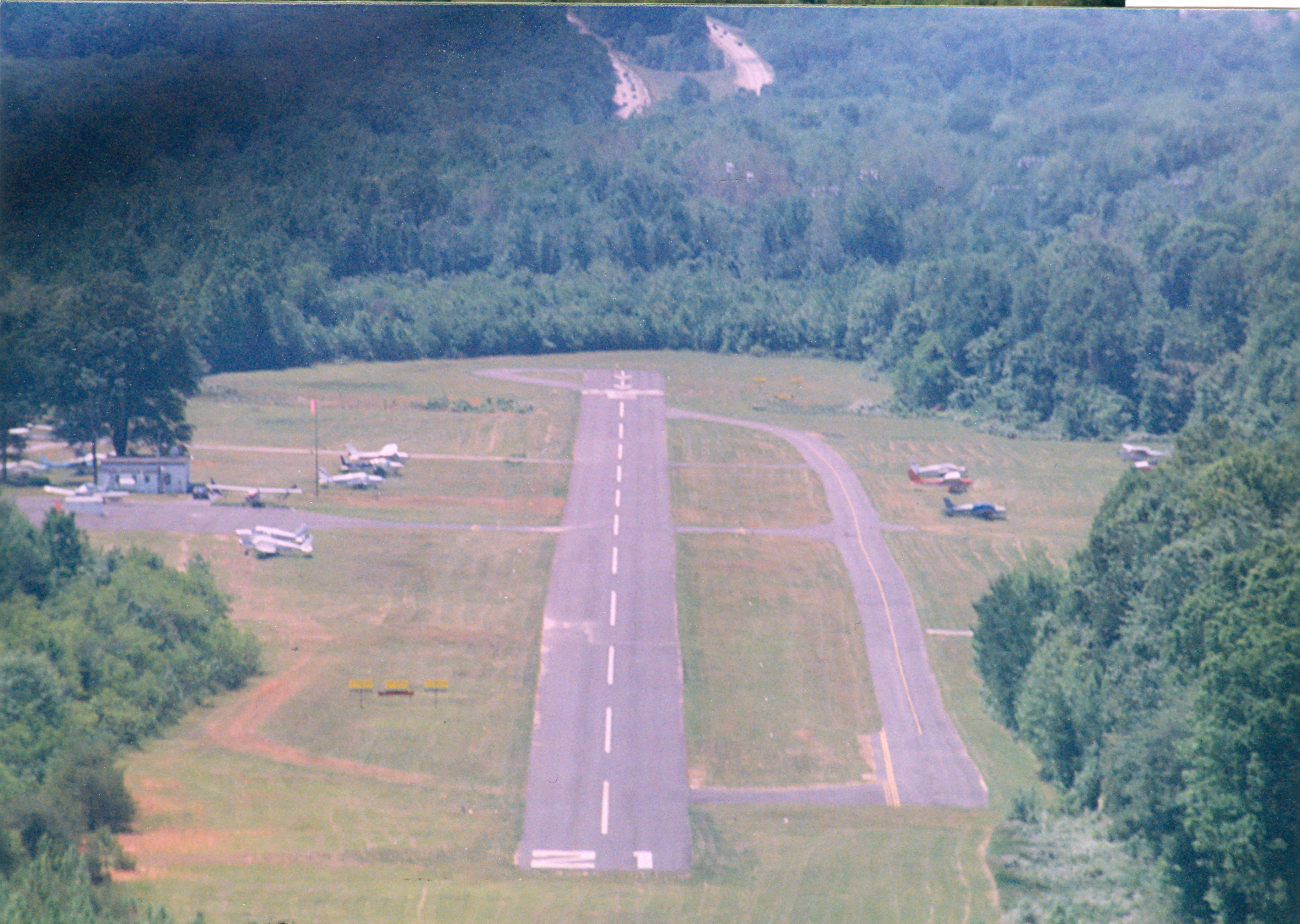
Suburban Airport (FAA LID: W18) is a public-use airport located in Anne Arundel County, Maryland, United States two miles (3 km) southeast of the central business district of Laurel. This airport is privately owned by Suburban Air Park LLC. Facilities and aircraftSuburban Airport covers an area of 52 acres (21 ha) which contains one paved runway (3/21) measuring 2,324 x 40 ft (708 x 12 m). For 12-month period ending April 24, 2007, the airport had 20,400 aircraft operations, an average of 55 per day, 100% of which were general aviation. There are 66 aircraft based at this airport, including 65 single engine airplanes and 1 helicopter. A combination of grass, paved-pad, ramp, owner-maintained fabric hangers, and steel hangers are available for aircraft to base from. The airport hosts homebuilt experimental aircraft, and has been the primary construction site of several aircraft past and present. HistorySuburban airport lies on ground once owned by the Snowden Family. The family manor "Birmingham" was built in 1690, and sat adjacent to the runway on what is now the Northbound lanes of the Baltimore-Washington Parkway. The Snowden family cemetery sits just to the east of the runway, within the traffic pattern. This historic location was the home of the first Iron production in Maryland, Patuxent Iron Works. Just to the west of the airport is a later Snowden family manor, Montpelier. Suburban Airport opened in March 1960 as a family run airport and fixed base operation. The first aircraft flown into the field was a Erco Ercoupe
The airport hosts meetings of the Experimental Aircraft Association and aviation oriented youth education programs such as Young Eagles flights. The airport has been a Piper Aircraft dealer. In 2001 Suburban Airport was closed for operations by the September 11 attacks. Aircraft had limited access to leave, then eventually arrivals and departures were granted under the flight rules of the Washington Air Defense Identification Zone. Suburban airport is currently owned by W18 LLC, an entity co-located with Bay Area Land Development and Polm Housing. The airport property is in a region affected by Base Realignment and Closure and gambling legislation at the nearby Laurel Park Racecourse. In 2004 Polm attempted to increase the zoning of the airport property from 21 allowable housing units to 641 units for a development called Riverwood. Polm publicly announced plans prior to the hearing to expand Suburban airport to support 300 aircraft, 100 hangers, helicopter charters, and operate a flight school if the increased zoning failed. 250 people attented the zoning hearing where the Riverwood zoning attempt did not pass. The same hearing passed zoning changes for the Polm development Fieldstone on the same road. In 2009 Polm offered to build a 715 seat privately run school if Riverwood zoning is approved.
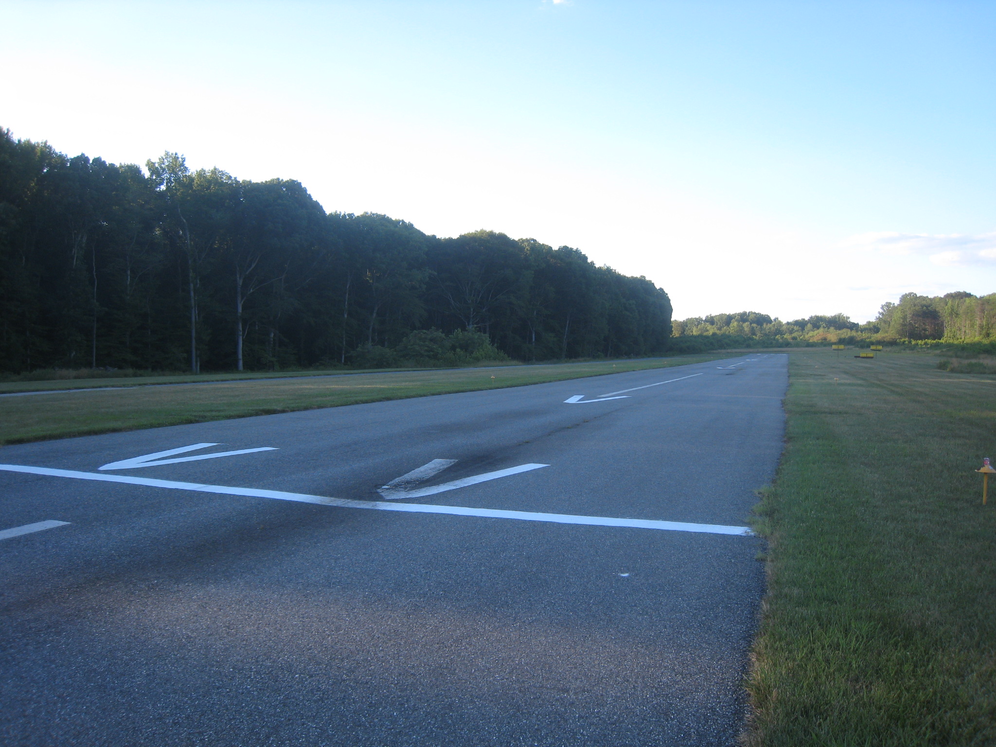
In 2010 The Maryland Aviation Administration changed the criteria for minimum approach angles and marked the airport with new displaced thresholds. The thresholds shortened 1/3 of the runway for landing operations both ways on the 2300 ft runway. Organizations that provided aircraft for Young Eagles flights have needed to relocate because the available runway was reduced beyond safe operating limits of thier aircraft. The above content comes from Wikipedia and is published under free licenses – click here to read more.
Location & QuickFacts
Owner & Manager
Airport Operations and Facilities
Airport Communications
Airport Services
Runway InformationRunway 03/21
Radio Navigation Aids
Remarks
Images and information placed above are from We thank them for the data!
We don't guarantee the information is fresh and accurate. The data may
be wrong or outdated.
|
||||||||||||||||||||||||||||||||||||||||||||||||||||||||||||||||||||||||||||||||||||||||||||||||||||||||||||||||||||||||||||||||||||||||||||||||||||||||||||||||||||||||||||||||||||||||||||||||||||||||||||||||||||||||||||||||||||||||||||||||||||||||||||||||||||||||||||||||||||||||||||||||||||||||||||||||||||||||||||||||||||||||||||||||||||||||||||||||||||||||||||||||||||||||||||||||||||||||||||||||||||||||

 |
|
Copyright 2004-2026 © by Airports-Worldwide.com, Vyshenskoho st. 36, Lviv 79010, Ukraine Legal Disclaimer |