 |
|
| Gorham Airport |
| IATA: none – ICAO: none – FAA LID: 2G8 |
| Summary |
| Airport type |
Private |
| Operator |
Gorham Water & Sewer Department |
| Location |
Gorham, New Hampshire |
| Elevation AMSL |
835 ft / 255 m |
| Coordinates |
44°23′35″N 71°11′48″W / 44.39306°N 71.19667°W / 44.39306; -71.19667 |
| Runways |
| Direction |
Length |
Surface |
| ft |
m |
| 12/30 |
2,667 |
813 |
Turf |
| Source: Federal Aviation Administration |
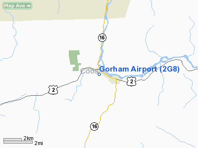
Gorham Airport (FAA LID: 2G8) is a private airport located in Gorham, New Hampshire, one mile (1.6 km) north-west of the central business district (CBD) of Gorham, in Coos County, New Hampshire, USA. Due to its proximity to Mt. Washington, the airport has been used to support glider flights exploring the wave system of the Presidential, Sandwich, Carter-Moriah, Pilot, Kinsman and Mahoosuc ranges in northern New Hampshire. Airlines and destinations
There are no commercial flights available.
The above content comes from Wikipedia and is published under free licenses – click here to read more.

Location & QuickFacts
| FAA Information Effective: | 2008-09-25 |
| Airport Identifier: | 2G8 |
| Airport Status: | Operational |
| Longitude/Latitude: | 071-11-48.2720W/44-23-35.2200N
-71.196742/44.393117 (Estimated) |
| Elevation: | 835 ft / 254.51 m (Estimated) |
| Land: | 15 acres |
| From nearest city: | 1 nautical miles NW of Gorham, NH |
| Location: | Coos County, NH |
| Magnetic Variation: | 17W (1985) |
Owner & Manager
| Ownership: | Publicly owned |
| Owner: | Gorham Water & Sewer Dept. |
| Address: | 8 Main Street
Gorham, NH 03581 |
| Phone number: | 603-466-3302 |
| Manager: | Lee Carroll |
| Address: | 8 Main St
Gorham, NH 03581 |
| Phone number: | 603-466-5065 |
Airport Operations and Facilities
| Airport Use: | Open to public |
| Wind indicator: | Yes |
| Segmented Circle: | No |
| Control Tower: | No |
| Landing fee charge: | No |
| Sectional chart: | Montreal |
| Region: | ANE - New England |
| Boundary ARTCC: | ZBW - Boston |
| Tie-in FSS: | BGR - Bangor |
| FSS on Airport: | No |
| FSS Toll Free: | 1-800-WX-BRIEF |
| NOTAMs Facility: | BGR (NOTAM-d service avaliable) |
Airport Communications
| CTAF: | 122.800 |
| Unicom: | 122.800 |
Airport Services
| Airframe Repair: | NONE |
| Power Plant Repair: | NONE |
Runway Information
Runway 12/30
| Dimension: | 2667 x 70 ft / 812.9 x 21.3 m |
| Surface: | TURF, Good Condition |
| |
Runway 12 |
Runway 30 |
| Longitude: | 071-12-11.0000W | 071-11-34.2693W |
| Latitude: | 44-23-40.8000N | 44-23-40.7201N |
| Traffic Pattern: | Left | Left |
| Obstruction: | 40 ft trees, 65 ft right of centerline | 33 ft tree, 165.0 ft from runway, 60 ft right of centerline, 5:1 slope to clear |
|
Radio Navigation Aids
| ID |
Type |
Name |
Ch |
Freq |
Var |
Dist |
| HIE | FAN MARKER | Witey | | | 17W | 15.9 nm |
| SZO | FAN MARKER | Grinn | | | 17W | 29.5 nm |
| HXK | NDB | Hornebrook | | 281.00 | 17W | 11.1 nm |
| GMA | NDB | Mahn | | 386.00 | 17W | 21.1 nm |
| SZO | NDB | Sebago | | 227.00 | 17W | 34.4 nm |
| LLX | NDB | Lyndonville | | 353.00 | 16W | 36.3 nm |
| RQM | NDB | Rangeley | | 221.00 | 18W | 37.7 nm |
| BML | VOR/DME | Berlin | 041X | 110.40 | 17W | 14.5 nm |
Remarks
- REFUELING AND MAINT OF ACFT IS PROHIBITED.
- ARPT CLSD NOV 1 - MAY 15. OTHR TIMES CHCK NOTAMS OR DURING NRML BUSINESS HRS ONLY CALL (603) 466-3302, LV TEL NMBR AND EXPECT RETURN CALL FOR FIELD CONDITION.
- WILDLIFE ON & INVOF ARPT.
- ARPT OPERATED AND MAINT BY CITY OF GORHAM WATER AND SEWER WORKS.
- NON-COMPLIANCE WITH FAR 157.
Images and information placed above are from
http://www.airport-data.com/airport/2G8/
We thank them for the data!
| General Info
|
| Country |
United States
|
| State |
NEW HAMPSHIRE
|
| FAA ID |
2G8
|
| Latitude |
44-23-35.220N
|
| Longitude |
071-11-48.272W
|
| Elevation |
835 feet
|
| Near City |
GORHAM
|
We don't guarantee the information is fresh and accurate. The data may
be wrong or outdated.
For more up-to-date information please refer to other sources.
|
 |


