 |
|
Iroquois Landing Seaplane Base Airport |

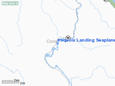
Location & QuickFacts
| FAA Information Effective: | 2008-09-25 |
| Airport Identifier: | 02NH |
| Airport Status: | Operational |
| Longitude/Latitude: | 071-13-08.6000W/44-39-25.7000N
-71.219056/44.657139 (Estimated) |
| Elevation: | 1180 ft / 359.66 m (Estimated) |
| Land: | 0 acres |
| From nearest city: | 6 nautical miles S of Dummer, NH |
| Location: | Coos County, NH |
| Magnetic Variation: | () |
Owner & Manager
| Ownership: | Privately owned |
| Owner: | Charles Kalil |
| Address: | Kalil's Fish & Game Farm, Rr1 Upper West Side Rd
N. Conway, NH 03860 |
| Phone number: | 603-356-2234 |
| Manager: | Charles Kalil |
| Address: | Kalil's Fish & Game Farm, Rr1 Upper West Side Rd.
N. Conway, NH 03860 |
| Phone number: | 603-356-2234 |
Airport Operations and Facilities
| Airport Use: | Private |
| Segmented Circle: | No |
| Control Tower: | No |
| Sectional chart: | Montreal |
| Region: | ANE - New England |
| Boundary ARTCC: | ZBW - Boston |
| Tie-in FSS: | BGR - Bangor |
| FSS Toll Free: | 1-800-WX-BRIEF |
Runway Information
Runway 18W/36W
| Dimension: | 3000 x 300 ft / 914.4 x 91.4 m |
| Surface: | WATER, |
| |
Runway 18W |
Runway 36W |
| Traffic Pattern: | Left | Left |
|
Helipad H1
| Dimension: | 20 x 20 ft / 6.1 x 6.1 m |
| Surface: | TURF, |
| |
Runway H1 |
Runway |
| Traffic Pattern: | Left | Left |
|
Radio Navigation Aids
| ID |
Type |
Name |
Ch |
Freq |
Var |
Dist |
| HIE | FAN MARKER | Witey | | | 17W | 22.9 nm |
| SZO | FAN MARKER | Grinn | | | 17W | 44.5 nm |
| HXK | NDB | Hornebrook | | 281.00 | 17W | 5.1 nm |
| RQM | NDB | Rangeley | | 221.00 | 18W | 26.0 nm |
| GMA | NDB | Mahn | | 386.00 | 17W | 26.7 nm |
| LLX | NDB | Lyndonville | | 353.00 | 16W | 35.9 nm |
| EFK | NDB | Newport | | 242.00 | 17W | 44.6 nm |
| SZO | NDB | Sebago | | 227.00 | 17W | 49.0 nm |
| BML | VOR/DME | Berlin | 041X | 110.40 | 17W | 2.0 nm |
| YSC | VORTAC | Sherbrooke | 079X | 113.20 | 17W | 46.4 nm |
Remarks
- OWNER DESIRES SPB & HELIPAD NOT BE CHARTED.
- IPADREMOVE TRUE ALIGNMENT TO SPB DOCK; CLEAR OR REMOVE OBSTN TREES ALL QUADRANTS AROUND HELIPAD TO PRVD CLEAR TLOF; INSTALL WIND INDICATOR; VFR OPNS; AND ALL USERS ARE NOTIFIED AND COMPLY W/THESE RESTRICTIONS.
Images and information placed above are from
http://www.airport-data.com/airport/02NH/
We thank them for the data!
|
 |


