 |
|
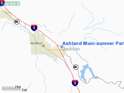
Ashland Muni-sumner Parker Field Airport |
Ashland Municipal Airport
Sumner Parker Field |
| IATA: none – ICAO: none – FAA LID: S03 |
| Summary |
| Airport type |
Public |
| Operator |
City of Ashland |
| Location |
Ashland, Oregon |
| Elevation AMSL |
1885 ft / 574.5 m |
| Coordinates |
42°11′25.0210″N 122°39′38.2620″W / 42.19028361°N 122.66062833°W / 42.19028361; -122.66062833 |
| Runways |
| Direction |
Length |
Surface |
| ft |
m |
| 12/30 |
3603 |
1098 |
asphalt |
Ashland Municipal Airport (FAA LID: S03), is a public airport located two miles (3.2 km) east of the city of Ashland in Jackson County, Oregon, USA.
The above content comes from Wikipedia and is published under free licenses – click here to read more.
Location & QuickFacts
| FAA Information Effective: | 2008-09-25 |
| Airport Identifier: | S03 |
| Airport Status: | Operational |
| Longitude/Latitude: | 122-39-38.2620W/42-11-25.0210N
-122.660628/42.190284 (Estimated) |
| Elevation: | 1885 ft / 574.55 m (Surveyed) |
| Land: | 94 acres |
| From nearest city: | 2 nautical miles E of Ashland, OR |
| Location: | Jackson County, OR |
| Magnetic Variation: | 18E (1985) |
Owner & Manager
| Ownership: | Publicly owned |
| Owner: | City Of Ashland |
| Address: | City Hall 2- E. Main St
Ashland, OR 97520 |
| Phone number: | 541-488-5587 |
| Manager: | Robert Skinner |
| Address: | 403 Dead Indian Memorial Road
Ashland, OR 97520 |
| Phone number: | 541-482-7675 |
Airport Operations and Facilities
| Airport Use: | Open to public |
| Wind indicator: | Yes |
| Segmented Circle: | Yes |
| Control Tower: | No |
| Lighting Schedule: | DUSK-DAWN
ACTVT MIRL RY 12/30, & REIL RY 30 - CTAF. VASI RYS 12 & 30 OPR 24 HRS. |
| Beacon Color: | Clear-Green (lighted land airport) |
| Landing fee charge: | No |
| Sectional chart: | Klamath Falls |
| Region: | ANM - Northwest Mountain |
| Traffic Pattern Alt: | 1015 ft |
| Boundary ARTCC: | ZSE - Seattle |
| Tie-in FSS: | MMV - Mc Minnville |
| FSS on Airport: | No |
| FSS Toll Free: | 1-800-WX-BRIEF |
| NOTAMs Facility: | MMV (NOTAM-d service avaliable) |
| Federal Agreements: | NGY |
Airport Communications
| CTAF: | 122.800 |
| Unicom: | 122.800 |
Airport Services
| Fuel available: | 100LLA |
| Airframe Repair: | MAJOR |
| Power Plant Repair: | MAJOR |
| Bottled Oxygen: | NONE |
| Bulk Oxygen: | NONE |
Runway Information
Runway 12/30
| Dimension: | 3603 x 75 ft / 1098.2 x 22.9 m |
| Surface: | ASPH, Good Condition |
| Weight Limit: | Single wheel: 15000 lbs. |
| Edge Lights: | Medium |
| |
Runway 12 |
Runway 30 |
| Longitude: | 122-39-53.2270W | 122-39-23.3000W |
| Latitude: | 42-11-38.9060N | 42-11-11.1360N |
| Elevation: | 1845.00 ft | 1885.00 ft |
| Alignment: | 127 | 127 |
| Traffic Pattern: | Left | Left |
| Markings: | Basic, Good Condition | Basic, Good Condition |
| Crossing Height: | 37.00 ft | 22.00 ft |
| Displaced threshold: | 0.00 ft | 190.00 ft |
| VASI: | 2-box on left side | 2-box on left side |
| Visual Glide Angle: | 3.75° | 4.00° |
| Runway End Identifier: | | Yes |
| Obstruction: | 40 ft trees, 250.0 ft from runway, 90 ft right of centerline, 1:1 slope to clear
+30 FT TREE 110 FT FM RY END 100 FT R.. | 30 ft trees, 410.0 ft from runway, 65 ft left of centerline, 7:1 slope to clear
+110 FT TREES 1325 FT 150 FT R; 12:1 BASED ON DSPLCD THLD. |
|
Radio Navigation Aids
| ID |
Type |
Name |
Ch |
Freq |
Var |
Dist |
| MEF | NDB | Medford | | 356.00 | 19E | 15.5 nm |
| MOG | NDB | Montague | | 404.00 | 19E | 29.0 nm |
| LFA | NDB | Merrill | | 347.00 | 17E | 47.0 nm |
| FJS | VOR/DME | Fort Jones | 033X | 109.60 | 19E | 45.0 nm |
| OED | VORTAC | Rogue Valley | 083X | 113.60 | 19E | 20.7 nm |
| LMT | VORTAC | Klamath Falls | 106X | 115.90 | 17E | 41.6 nm |
| MFR | VOT | Medford-jackson County | | 117.20 | | 13.6 nm |
Remarks
- RY 12 HAS 165 FT TERRAIN 5000 FT AT 29:1.
- DEER & BIRDS ON & INVOF ARPT
- 24 HR CREDIT CARD FUEL
Images and information placed above are from
http://www.airport-data.com/airport/S03/
We thank them for the data!
| General Info
|
| Country |
United States
|
| State |
OREGON
|
| FAA ID |
S03
|
| Latitude |
42-11-25.021N
|
| Longitude |
122-39-38.262W
|
| Elevation |
1885 feet
|
| Near City |
ASHLAND
|
We don't guarantee the information is fresh and accurate. The data may
be wrong or outdated.
For more up-to-date information please refer to other sources.
|
|


