 |
|
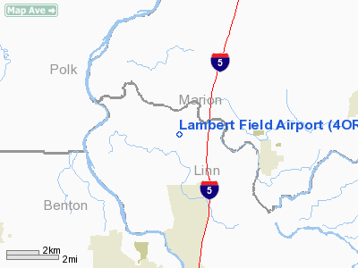
Location & QuickFacts
| FAA Information Effective: | 2008-09-25 |
| Airport Identifier: | 4OR3 |
| Airport Status: | Operational |
| Longitude/Latitude: | 123-04-33.3400W/44-43-49.4360N
-123.075928/44.730399 (Estimated) |
| Elevation: | 195 ft / 59.44 m (Estimated) |
| Land: | 0 acres |
| From nearest city: | 7 nautical miles N of Albany, OR |
| Location: | Linn County, OR |
| Magnetic Variation: | 19E (1990) |
Owner & Manager
| Ownership: | Privately owned |
| Owner: | Dwight E Lambert |
| Address: | 33111 Harnish
Albany, OR 97321 |
| Phone number: | 503-928-0903 |
| Manager: | Dwight E Lambert |
| Address: | 33111 Harnish
Albany, OR 97321 |
| Phone number: | 503-928-0903 |
Airport Operations and Facilities
| Airport Use: | Private |
| Wind indicator: | Yes |
| Segmented Circle: | No |
| Control Tower: | No |
| Sectional chart: | Seattle |
| Region: | ANM - Northwest Mountain |
| Boundary ARTCC: | ZSE - Seattle |
| Tie-in FSS: | MMV - Mc Minnville |
| FSS Toll Free: | 1-800-WX-BRIEF |
Runway Information
Runway 16/34
| Dimension: | 1700 x 100 ft / 518.2 x 30.5 m |
| Surface: | TURF, |
| |
Runway 16 |
Runway 34 |
| Traffic Pattern: | Right | Left |
| Obstruction: | 75 ft trees, 3000.0 ft from runway | 30 ft pline, 0.0 ft from runway
PLINE & ROAD ON S END. |
|
Radio Navigation Aids
| ID |
Type |
Name |
Ch |
Freq |
Var |
Dist |
| LWG | NDB | Lewisburg | | 225.00 | 18E | 10.9 nm |
| EU | NDB | Frakk | | 260.00 | 19E | 31.7 nm |
| CVO | VOR/DME | Corvallis | 101X | 115.40 | 18E | 16.7 nm |
| UBG | VOR/DME | Newberg | 121X | 117.40 | 21E | 37.7 nm |
| EUG | VORTAC | Eugene | 076X | 112.90 | 20E | 37.2 nm |
| ONP | VORTAC | Newport | 118X | 117.10 | 19E | 43.1 nm |
| HIO | VOT | Portland-hillsboro | | 115.20 | | 49.0 nm |
Remarks
- PRVD TFC PATTERNS ESTABLISHED WEST SIDE OF RY.
Images and information placed above are from
http://www.airport-data.com/airport/4OR3/
We thank them for the data!
| General Info
|
| Country |
United States
|
| State |
OREGON
|
| FAA ID |
4OR3
|
| Latitude |
44-43-49.436N
|
| Longitude |
123-04-33.340W
|
| Elevation |
195 feet
|
| Near City |
ALBANY
|
We don't guarantee the information is fresh and accurate. The data may
be wrong or outdated.
For more up-to-date information please refer to other sources.
|
|


