 |
|
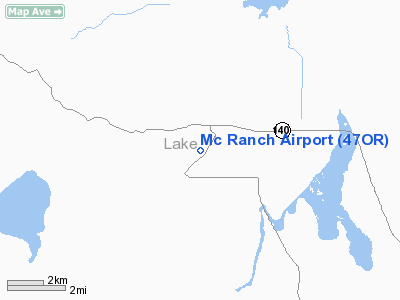
Location & QuickFacts
| FAA Information Effective: | 2008-09-25 |
| Airport Identifier: | 47OR |
| Airport Status: | Operational |
| Longitude/Latitude: | 119-54-17.8070W/42-09-53.5970N
-119.904946/42.164888 (Estimated) |
| Elevation: | 4555 ft / 1388.36 m (Estimated) |
| Land: | 70 acres |
| From nearest city: | 1 nautical miles S of Adel, OR |
| Location: | Lake County, OR |
| Magnetic Variation: | 17E (1985) |
Owner & Manager
| Ownership: | Privately owned |
| Owner: | Sam Farr |
| Address: | Hc 60, Box 4710
Lakeview, OR 97630 |
| Phone number: | 503-947-4586 |
| Manager: | Sam Farr |
| Address: | Hc 60 Box 4710
Lakeview, OR 97630 |
| Phone number: | 503-947-4586 |
Airport Operations and Facilities
| Airport Use: | Private |
| Wind indicator: | Yes |
| Segmented Circle: | No |
| Control Tower: | No |
| Landing fee charge: | No |
| Sectional chart: | Klamath Falls |
| Region: | ANM - Northwest Mountain |
| Boundary ARTCC: | ZSE - Seattle |
| Tie-in FSS: | MMV - Mc Minnville |
| FSS on Airport: | No |
| FSS Toll Free: | 1-800-WX-BRIEF |
Runway Information
Runway 01/19
| Dimension: | 3400 x 70 ft / 1036.3 x 21.3 m |
| Surface: | DIRT, Fair Condition |
| |
Runway 01 |
Runway 19 |
| Traffic Pattern: | Left | Left |
|
Radio Navigation Aids
| ID |
Type |
Name |
Ch |
Freq |
Var |
Dist |
| LKV | VORTAC | Lakeview | 57X | 112.00 | 19E | 33.2 nm |
Remarks
- FILED FOR RECORD PURPOSES ONLY.
Images and information placed above are from
http://www.airport-data.com/airport/47OR/
We thank them for the data!
| General Info
|
| Country |
United States
|
| State |
OREGON
|
| FAA ID |
47OR
|
| Latitude |
42-09-53.597N
|
| Longitude |
119-54-17.807W
|
| Elevation |
4555 feet
|
| Near City |
ADEL
|
We don't guarantee the information is fresh and accurate. The data may
be wrong or outdated.
For more up-to-date information please refer to other sources.
|
|


