 |
|
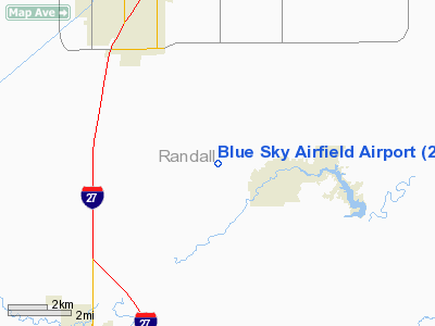
Blue Sky Airfield Airport |
Location & QuickFacts
| FAA Information Effective: | 2008-09-25 |
| Airport Identifier: | 2TX0 |
| Airport Status: | Operational |
| Longitude/Latitude: | 101-50-57.6780W/35-03-52.1970N
-101.849355/35.064499 (Estimated) |
| Elevation: | 3615 ft / 1101.85 m (Estimated) |
| Land: | 0 acres |
| From nearest city: | 9 nautical miles S of Amarillo, TX |
| Location: | Randall County, TX |
| Magnetic Variation: | 09E (1990) |
Owner & Manager
| Ownership: | Privately owned |
| Owner: | Blue Sky Airfield, Inc. |
| Address: | P.o. Box 1383
Amarillo, TX 79105 |
| Phone number: | 806-467-1651 |
| Manager: | Don Johnson |
| Address: | 2802 Bowie Street
Amarillo, TX 79109 |
| Phone number: | 806-467-1651
CELL - 806-614-1221. |
Airport Operations and Facilities
| Airport Use: | Private |
| Wind indicator: | Yes |
| Segmented Circle: | No |
| Control Tower: | No |
| Sectional chart: | Dallas-ft Worth |
| Region: | ASW - Southwest |
| Boundary ARTCC: | ZAB - Albuquerque |
| Tie-in FSS: | FTW - Fort Worth |
| FSS on Airport: | No |
| FSS Phone: | 817-541-3474 |
| FSS Toll Free: | 1-800-WX-BRIEF |
Runway Information
Runway 17/35
| Dimension: | 3800 x 60 ft / 1158.2 x 18.3 m |
| Surface: | TURF, |
| |
Runway 17 |
Runway 35 |
| Traffic Pattern: | Left | Right |
|
Radio Navigation Aids
| ID |
Type |
Name |
Ch |
Freq |
Var |
Dist |
| AM | NDB | Pande | | 251.00 | 09E | 5.4 nm |
| HRX | NDB | Hereford | | 341.00 | 09E | 26.5 nm |
| DUX | NDB | Durrett | | 414.00 | 09E | 48.7 nm |
| PNH | VORTAC | Panhandle | 113X | 116.60 | 08E | 12.6 nm |
Images and information placed above are from
http://www.airport-data.com/airport/2TX0/
We thank them for the data!
| General Info
|
| Country |
United States
|
| State |
TEXAS
|
| FAA ID |
2TX0
|
| Latitude |
35-03-52.197N
|
| Longitude |
101-50-57.678W
|
| Elevation |
3615 feet
|
| Near City |
AMARILLO
|
We don't guarantee the information is fresh and accurate. The data may
be wrong or outdated.
For more up-to-date information please refer to other sources.
|
|


