 |
|
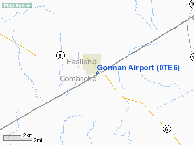
Location & QuickFacts
| FAA Information Effective: | 2008-09-25 |
| Airport Identifier: | 0TE6 |
| Airport Status: | Operational |
| Longitude/Latitude: | 098-39-56.1960W/32-12-15.4950N
-98.665610/32.204304 (Estimated) |
| Elevation: | 1452 ft / 442.57 m (Estimated) |
| Land: | 10 acres |
| From nearest city: | 1 nautical miles SE of Gorman, TX |
| Location: | Eastland County, TX |
| Magnetic Variation: | 07E (1985) |
Owner & Manager
| Ownership: | Privately owned |
| Owner: | W. C. Smith |
| Address: | Po Box 158
Gorman, TX 76454 |
| Phone number: | 817-734-2233 |
| Manager: | W. C. Smith |
| Address: | Po Box 158
Gorman, TX 76454 |
| Phone number: | 817-734-2233 |
Airport Operations and Facilities
| Airport Use: | Private
LIGHT ACFT WELCOME; LAND AT OWN RISK. |
| Wind indicator: | No |
| Segmented Circle: | No |
| Control Tower: | No |
| Landing fee charge: | No |
| Sectional chart: | Dallas-ft Worth |
| Region: | ASW - Southwest |
| Boundary ARTCC: | ZFW - Fort Worth |
| Tie-in FSS: | FTW - Fort Worth |
| FSS on Airport: | No |
| FSS Phone: | 817-541-3474 |
| FSS Toll Free: | 1-800-WX-BRIEF |
Airport Services
| Fuel available: | 80 |
| Airframe Repair: | NONE |
| Power Plant Repair: | MINOR |
Runway Information
Runway 16/34
| Dimension: | 2575 x 50 ft / 784.9 x 15.2 m |
| Surface: | DIRT, |
| |
Runway 16 |
Runway 34 |
| Traffic Pattern: | Left | Right |
|
Radio Navigation Aids
| ID |
Type |
Name |
Ch |
Freq |
Var |
Dist |
| OIP | NDB | Old Rip | | 410.00 | 07E | 13.8 nm |
| BKD | NDB | Breckenridge | | 245.00 | 07E | 34.6 nm |
| COM | NDB | Coleman | | 385.00 | 07E | 43.6 nm |
| MNZ | NDB | Hamilton | | 251.00 | 07E | 43.9 nm |
| MWL | NDB | Mineral Wells | | 266.00 | 06E | 46.6 nm |
| GZV | NDB | Brazos River | | 280.00 | 07E | 46.7 nm |
| BWD | VOR/DME | Brownwood | 023X | 108.60 | 08E | 23.9 nm |
| JEN | VORTAC | Glen Rose | 097X | 115.00 | 06E | 40.2 nm |
| MQP | VORTAC | Millsap | 124X | 117.70 | 09E | 46.2 nm |
Remarks
Images and information placed above are from
http://www.airport-data.com/airport/0TE6/
We thank them for the data!
| General Info
|
| Country |
United States
|
| State |
TEXAS
|
| FAA ID |
0TE6
|
| Latitude |
32-12-15.495N
|
| Longitude |
098-39-56.196W
|
| Elevation |
1452 feet
|
| Near City |
GORMAN
|
We don't guarantee the information is fresh and accurate. The data may
be wrong or outdated.
For more up-to-date information please refer to other sources.
|
|


