 |
|
| Skyway Manor Airport |
| IATA: none – ICAO: none – FAA LID: T79 |
| Summary |
| Airport type |
Public |
| Owner |
Skyway Manor |
| Serves |
Pearland, Texas |
| Elevation AMSL |
55 ft / 17 m |
| Coordinates |
29°33′21″N 095°19′41″W / 29.55583°N 95.32806°W / 29.55583; -95.32806 |
| Runways |
| Direction |
Length |
Surface |
| ft |
m |
| 17/35 |
2,550 |
777 |
Turf |
| Statistics (2006) |
| Aircraft operations |
2,400 |
| Source: Federal Aviation Administration |
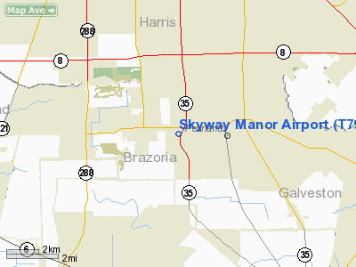
Skyway Manor Airport (FAA LID: T79) is a public-use airport located three nautical miles (6 km) west of the central business district of Pearland, a city in Brazoria County, Texas, United States. The airport is privately owned by Skyway Manor.
Facilities and aircraft
Skyway Manor Airport covers an area of 24 acres (10 ha) at an elevation of 55 feet (17 m) above mean sea level. It has one runway designated 17/35 with a turf surface measuring 2,550 by 70 feet (777 x 21 m). For the 12-month period ending November 22, 2006, the airport had 2,400 aircraft operations, an average of 200 per month, all of which were general aviation. There are no commercial flights.
The above content comes from Wikipedia and is published under free licenses – click here to read more.

Location & QuickFacts
| FAA Information Effective: | 2008-09-25 |
| Airport Identifier: | T79 |
| Airport Status: | Operational |
| Longitude/Latitude: | 095-19-40.7750W/29-33-20.8420N
-95.327993/29.555789 (Estimated) |
| Elevation: | 55 ft / 16.76 m (Estimated) |
| Land: | 24 acres |
| From nearest city: | 3 nautical miles W of Pearland, TX |
| Location: | Brazoria County, TX |
| Magnetic Variation: | 06E (1985) |
Owner & Manager
| Ownership: | Privately owned |
| Owner: | Skyway Manor |
| Address: | 2736 Piper Road
Pearland, TX 77584 |
| Phone number: | 281-485-4755 |
| Manager: | Richard Wells |
| Address: | 2736 Piper Road
Pearland, TX 77584 |
| Phone number: | 281-485-4755 |
Airport Operations and Facilities
| Airport Use: | Open to public |
| Wind indicator: | Yes |
| Segmented Circle: | No |
| Control Tower: | No |
| Landing fee charge: | No |
| Sectional chart: | Houston |
| Region: | ASW - Southwest |
| Boundary ARTCC: | ZHU - Houston |
| Tie-in FSS: | CXO - Montgomery County |
| FSS on Airport: | No |
| FSS Toll Free: | 1-800-WX-BRIEF
FOR FP FILING CALL CXO FSS 1-800-992-7433. |
| NOTAMs Facility: | CXO (NOTAM-d service avaliable) |
Airport Communications
Runway Information
Runway 17/35
| Dimension: | 2550 x 70 ft / 777.2 x 21.3 m |
| Surface: | TURF, Fair Condition
SOFT WHEN WET. |
| |
Runway 17 |
Runway 35 |
| Traffic Pattern: | Left | Left |
| Obstruction: | 35 ft pline, 110.0 ft from runway, 3:1 slope to clear | 35 ft pline, 100.0 ft from runway, 2:1 slope to clear |
|
Radio Navigation Aids
| ID |
Type |
Name |
Ch |
Freq |
Var |
Dist |
| SYG | NDB | Sandy Point | | 402.00 | 05E | 8.0 nm |
| JPA | NDB | Sanjac | | 347.00 | 05E | 15.1 nm |
| SGR | NDB | Hull | | 388.00 | 05E | 17.8 nm |
| LYD | NDB | Lakeside | | 249.00 | 05E | 24.1 nm |
| BVP | NDB | Nixin | | 326.00 | 05E | 27.0 nm |
| EYQ | NDB | Weiser | | 286.00 | 06E | 28.0 nm |
| GLS | NDB | Galveston | | 206.00 | 08E | 32.8 nm |
| DWH | NDB | David Hooks | | 521.00 | 05E | 36.4 nm |
| CBC | NDB | Anahuac | | 413.00 | 05E | 37.1 nm |
| BYY | NDB | Bay City | | 344.00 | 06E | 44.8 nm |
| ARM | NDB | Wharton | | 245.00 | 06E | 46.8 nm |
| EFD | TACAN | Ellington | 031X | | 05E | 9.3 nm |
| HUB | VOR/DME | Hobby | 118X | 117.10 | 05E | 6.6 nm |
| MHF | VOR/DME | Trinity | 083X | 113.60 | 07E | 30.4 nm |
| IAH | VORTAC | Humble | 113X | 116.60 | 05E | 24.1 nm |
| VUH | VORTAC | Scholes | 077X | 113.00 | 06E | 29.6 nm |
| HOU | VOT | Houston Wm P Hobby | | 108.40 | | 6.0 nm |
Remarks
- NUMEROUS VIOLATIONS OF PRIM SFC ENTIRE RWY LGTH; BLDGS, FENCES, TREES & BRUSH.
- NO TOUCH AND GO LANDINGS
- PRVDD THRS DSPLD & MKD TO PRVD MIN 20:1 CLNC OVR PLINES & ANY/ALL OTR OBSTNS FINAL APCH; PLINES ADJT RWY ENDS OBSTN MKD IAW CHAPTER 3 AC 70/7460-2E. OWNER ENSURES PRESENCE OF OBSTNS IN RWY APCH AREAS ARE ADVERTISED TO ALERT TRANSIENT PILOTS.
Images and information placed above are from
http://www.airport-data.com/airport/T79/
We thank them for the data!
| General Info
|
| Country |
United States
|
| State |
TEXAS
|
| FAA ID |
T79
|
| Latitude |
29-33-20.842N
|
| Longitude |
095-19-40.775W
|
| Elevation |
55 feet
|
| Near City |
PEARLAND
|
We don't guarantee the information is fresh and accurate. The data may
be wrong or outdated.
For more up-to-date information please refer to other sources.
|
 |


